I had expected to follow up my list of great places to camp in western Mexico with a selection of wonderful hot springs and rivers where you might soak away your troubles. Due to the pandemic, however, most of those delightful sites are temporarily closed to the public. So what to do and where to go in time of Covid-19?
How about a mirador, or lookout point, where you could enjoy a picnic with a view? In western Mexico, such spots are found not only atop mountains and volcanoes but often at the edge of huge, gorgeous canyons.
In none of the places suggested below are you likely to find more than a handful of people, so you should be able to breathe in fresh air without a mask while soaking up the great vibes of a wide panorama stretching as far as the eye can see; just what you need to recharge your batteries after a week of Zoom meetings and shopping via internet.
El Chante Hang Glider Launch
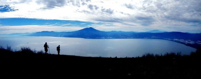
Our first belvedere is located 600 meters above El Chante, at the northwest corner of Lake Chapala. From the hang glider launching spot at the south end of an open meadow, you will enjoy a spectacular 180-degree view of Mexico’s biggest lake and the villages dotting its shore. While this is one of the best places to see the lake, note that it takes a two-hour hike to get up there. However, Gerry Green, who wrote the book on hiking in these hills, comments that the trail is “wide, well used and not too steep.”
If you prefer lookouts closer to where you left your car, see below. To check out the trail, just Google: “Fuentes-GliderLaunch-Chante Loop Wikiloc”.

The Etzatlán Mirador
The charming little town of Etzatlán lies 65 kilometers northwest of Guadalalajara. It is perhaps best known as the gateway to the celebrated silver and gold mines of the Amparo Mining Company and home of its mint, but it made the news in 2019 when Guinness World Records certified that the townspeople had created the world’s largest crochet canopy, measuring nearly 3,000 square meters.
A four-kilometer drive along a well-paved highway will take you to Etzatlán’s mirador, where you’ll have a good view of the town and surrounding hills … and perhaps a bird’s eye view of the giant crochet canopy as well. Ask Google Maps to take you to “QW38+6R Etzatlán, Jalisco”.
Ceboruco Volcano
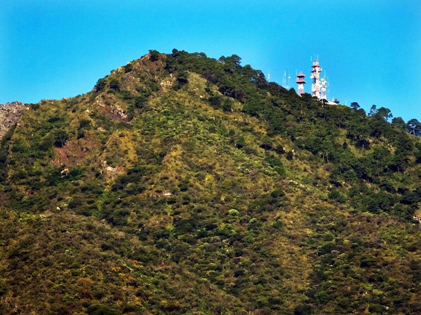
An old-timer in Nayarit once told me that the most beautiful sight he had ever seen was the view from the top of Ceboruco Volcano, so I think it deserves high marks among the miradores of western Mexico. The volcano is located right along the toll road from Guadalajara to Puerto Vallarta and a well paved cobblestone road will take you up to the very top. Along the way you can appreciate dramatically changing flora and you’ll even come upon a fumarole or two. When you’ve gone as high as you can possibly go, you’ll be at the foot of huge microwave antennas. Park and walk to the other side of the antennas for the spectacular view.
La Leonera
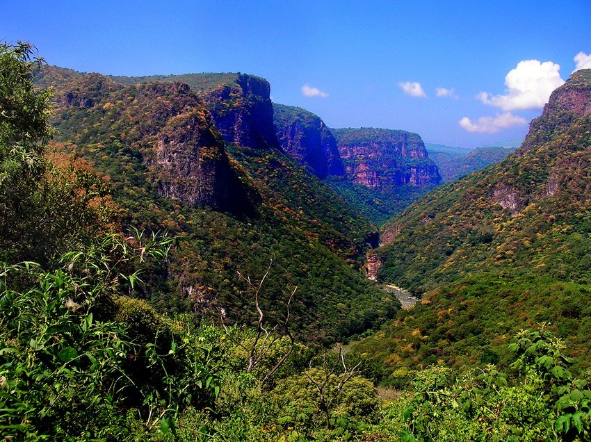
Jalisco’s Rio Verde has carved a magnificent canyon over 170 kilometers in length and one of the best places to view it is from La Leonera, located 40 kilometers northeast of Guadalajara, near the town of Acatic. The mirador is just a few steps from where you park your car, but you can see a lot more of the canyon far below if you walk along a wide footpath which leads to 60-meter tall Velo de la Novia Waterfall.
To get there, let Google Maps take you to “R3PM+42 Acatic, Jalisco.”
Mirador el Filete
The Manantlán Biosphere Reserve straddles the Mexican states of Jalisco and Colima and is home to an astounding variety of flora and fauna. One of the reserve’s most beautiful attractions is the view from Mirador el Filete, which means something like Knife Blade Lookout. From this thin slice of rock, they say, you can see the Pacific on a clear day. To reach the spot, you must walk for half an hour, but you will be walking through a cloud forest, so along the way you are going to see so many wonderful things — from bromeliads and orchids to blue mushrooms and Spanish moss — that the walk will surely turn out to take far longer than you expected.
To visit this lookout point, head for El Terrero, Colima. Once you are there, ask one of the local people to guide you to El Filete.
Mirador Cruz de los Volcancillos
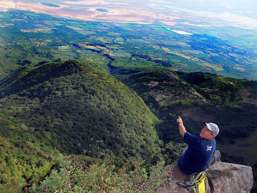
Also known as The Hermit’s Cross and El Divisadero, this is one of the most spectacular lookout points in Jalisco’s Sierra de Tapalpa, home to many a fine mirador. There’s a giant cross here, identical to many others on Mexican cliffs and hilltops, but just a few meters beyond it, there is a truly awesome place where you can sit on a rock overhanging a sheer drop of … well, I calculate a full kilometer and a half. Yes, it’s just about a mile straight down, and in the good old Mexican tradition, there is no railing to be seen anywhere. I swear this is one mirador you are not likely to forget!
Ask Google Maps to take you to “399R+6X Techaluta de Montenegro, Jalisco.” When you are about a kilometer from El Divisadero, you may have to park and walk if the road looks bad. If you have a high clearance vehicle and the weather is dry, you can drive all the way to the lookout point.
Las Águilas
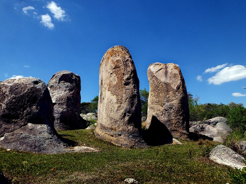
Las Águilas has been called Mexico’s Stonehenge. The site is located 129 kilometers southwest of Guadalajara, near the town of Cuautla, Jalisco.
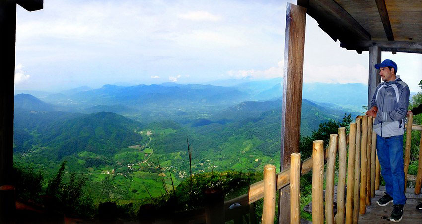
Whether Las Águilas once served as an astronomical observatory or whether it is a “power center,” as Carlos Castaneda supposedly claimed, I really can’t say, but simply wandering among its tall, majestic monoliths is an experience worth having. On top of that, there is a great view from the sheltered belvedere constructed by locals.
For the route to this site, Google: “Las Aguilas Cuautla Jalisco Wikiloc.”
The writer has lived near Guadalajara, Jalisco, for 31 years, and is the author of “A Guide to West Mexico’s Guachimontones and Surrounding Area” and co-author of “Outdoors in Western Mexico.” More of his writing can be found on his website.
