Approximately 20,000 people who used to be from Chiapas no longer know which state they live in after the Oaxaca state congress voted on Wednesday to modify the border with its neighboring state.
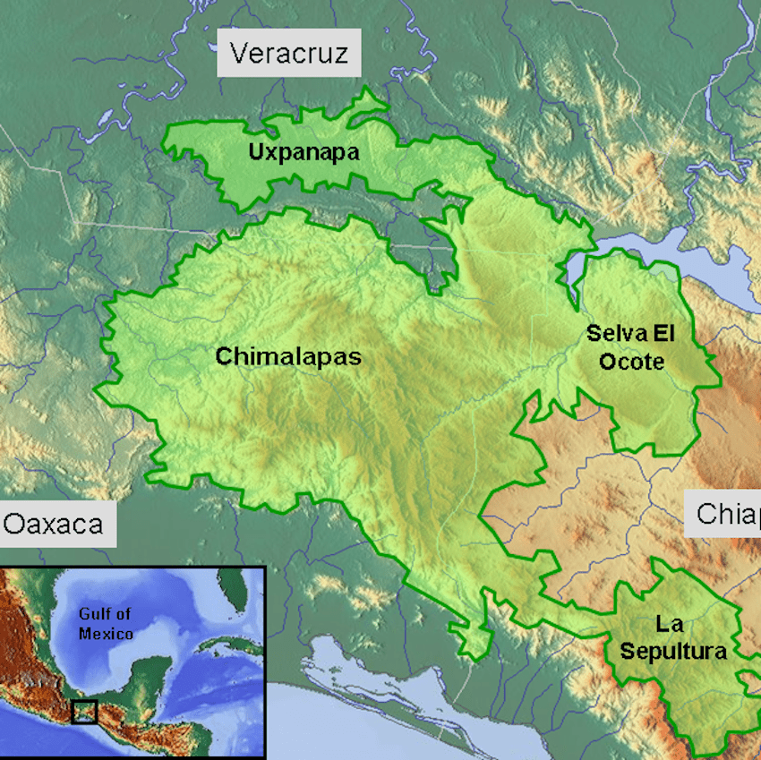
The vote complies with a March 2022 ruling by the Mexican Supreme Court (SCJN), which ordered that a 162,000-hectare territory known as Chimalapas be returned to the Zoque indigenous communities of Oaxaca.
Since last year’s ruling, the Zoque communities have protested to demand that Oaxaca governor Salomón Jara Cruz comply with the SCJN’s mandate.
The ruling was the result of a decades-long campaign led by the Zoque communities of San Miguel and Santa María Chimalapa, who filed an injunction with the SCJN in 2012, arguing that their rightful territories had been invaded by cattle ranchers and loggers from Chiapas.
However, the border change also affects several non-Zoque communities that settled later in the area: Rodulfo Figueroa, Belisario Domínguez, Cal and Mayor. The National Electoral Institute (INE) has stopped issuing credentials to the 20,000 residents of these areas until it is confirmed whether they are residents of Oaxaca or Chiapas.
“The government of Chiapas cannot oppose a court order,” said Geovany Vásquez Sagrero, head of Oaxaca’s Office of Legal Counsel. “However, honestly, we have to say that there is a strip in the southern part [of the affected area] that no longer has anything to do with Chimalapas.”
Vásquez recognized that these communities see themselves as from Chiapas but said that talks are underway to persuade them to accept being part of Oaxaca.

The new Oaxaca-Chiapas border will start at the Tonalá peninsula at a latitude of 16 degrees north, head north to Cerro del Chilillo, continue northwest to Cerro de La Jineta, then northeast to Cerro de los Martínez, in the tri-border area with Veracruz.
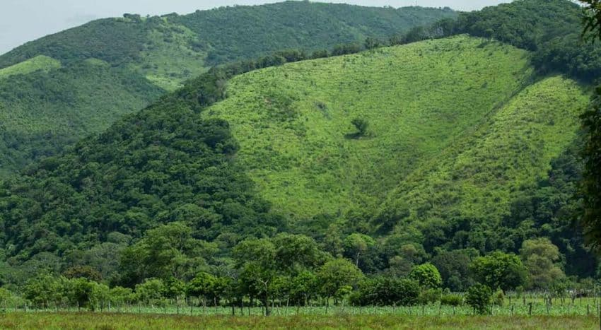
The affected area is covered with dense forest and is considered one of the most biodiverse ecosystems in the Americas.
The border dispute began in 1950, when the Chiapas government granted five logging concessions to two companies, allowing them to seize 100,000 hectares of communal forest belonging to the Zoque communities.
To legitimize these concessions, the communal territories were redesignated as national lands in the municipality of Cintalapa, Chiapas. Later, the Chiapas government granted spaces within these areas to displaced Tzotzil communities from the highlands of Chiapas.
Although the conflict was temporarily resolved in 1967 with a presidential resolution that recognized and titled communal property, it flared up again following the creation of the Chiapas municipality of Belisario Domínguez in 2011.
In 2018, the previous Chiapas legislature created the “Special Commission to address the Chimalapas case,” which sought to preserve the Chimalapas region as part of Chiapas.
However, this commission has refused to make any comment on the SCJN’s ruling in favor of Oaxaca and announced that they are no longer in office.
With reports from El Heraldo de Chiapas