There are few better ways to get to know a city than from the seat of a bus. In Puerto Vallarta, that seat might be plastic, slightly cracked and surprisingly loud, but it comes with a front-row view of daily life in one of Mexico’s most beloved beach towns. And for just 10 pesos a ride, it’s one of the best bargains in the Bay.
If you’re visiting Puerto Vallarta, or perhaps newly settling in, here’s everything you need to know to make the most of this humble yet efficient public transport network.
First things first: Where’s the bus stop?
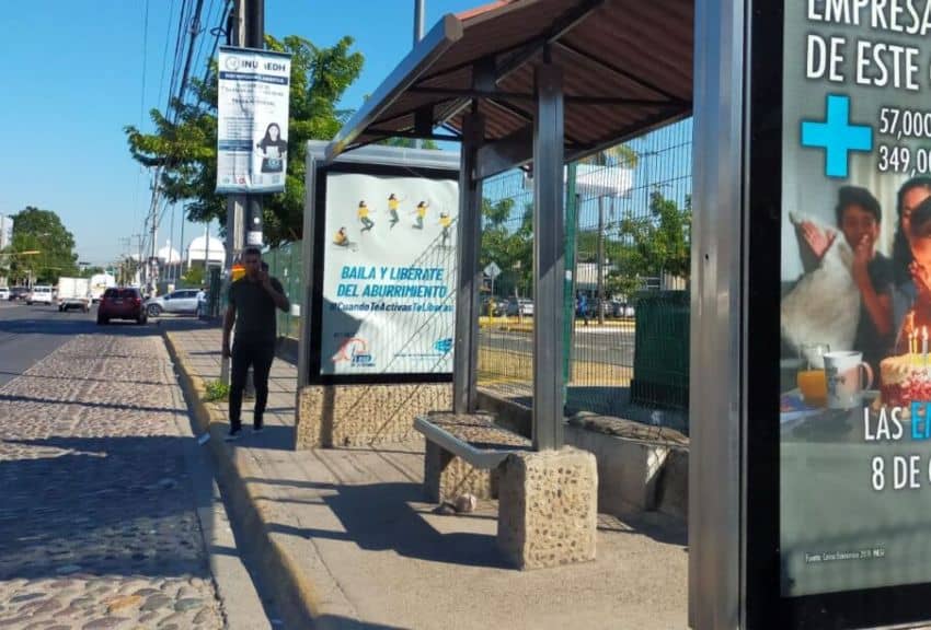
Puerto Vallarta’s bus stops are often more concept than structure. While some are marked by a small sign or faded shelter, many have simply vanished — or never existed in the first place. Locals know the drill: gather on a familiar corner and wait. Your best bet is to look for a small group of people standing together, especially near intersections. That’s your cue.
Out in the colonias (neighborhoods farther from the tourist zone), the system is a bit more flexible. Buses will stop just about anywhere someone’s waiting: at a corner, in the middle of the road, or even waving from the sidewalk. A raised hand doesn’t guarantee the bus will stop, but point purposefully to the road in front of you and you may get lucky.
Welcome aboard: What to expect
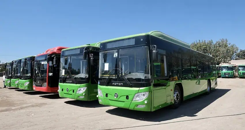
Yes, Puerto Vallarta has new buses. And they’re great. Many are clean, powered by natural gas, and technically have air conditioning, though don’t count on the A/C being turned on. Still, they beat the sweltering metal boxes of years past. Though, depending on the route, you may be blessed with a ride aboard these rickety time capsules.
Fares are flat: 10 pesos gets you just about anywhere in the city proper. Pro tip: Once aboard, get to your seat fast. Drivers don’t always wait for you to settle before gunning it. And while the first few rows — often painted yellow — are reserved for the elderly, disabled or pregnant, the rest of the bus is fair game.
The routes: Centro, Túnel and beyond

Navigating the bus system is surprisingly intuitive if you know what to look for. Buses have signs in their front windows indicating their general route. If you’re heading downtown from the Hotel Zone, grab a bus marked “Centro.” This one snakes through downtown and ends in the Zona Romantica.
Want to skip the congestion of El Centro and get to the Zona faster? Take a bus marked “Túnel.” This route bypasses downtown via the tunnels, offering a theoretically speedier ride with a peek at the hills and backstreets of Vallarta most tourists never see. Whether or not it’s faster to go through the tunnel, due to traffic and speed bumps, is up for debate. I’ve personally never timed it.
If you’re southbound toward Mismaloya or Boca de Tomatlán, head to the terminal at Constitución and Basilio Badillo. Buses depart regularly and cost the standard 10 pesos. These are also your rides to the Puerto Vallarta Zoo — get off at the Barcelo Hotel in Mismaloya — or onward to sleepy villages.
Going further afield

Looking for the Botanical Gardens or the cool mountain town of El Tuito? Those buses leave from Aguacate and Basilio Badillo. Expect to pay around 40–50 pesos for the ride and plan for at least 50 minutes.
A few local quirks
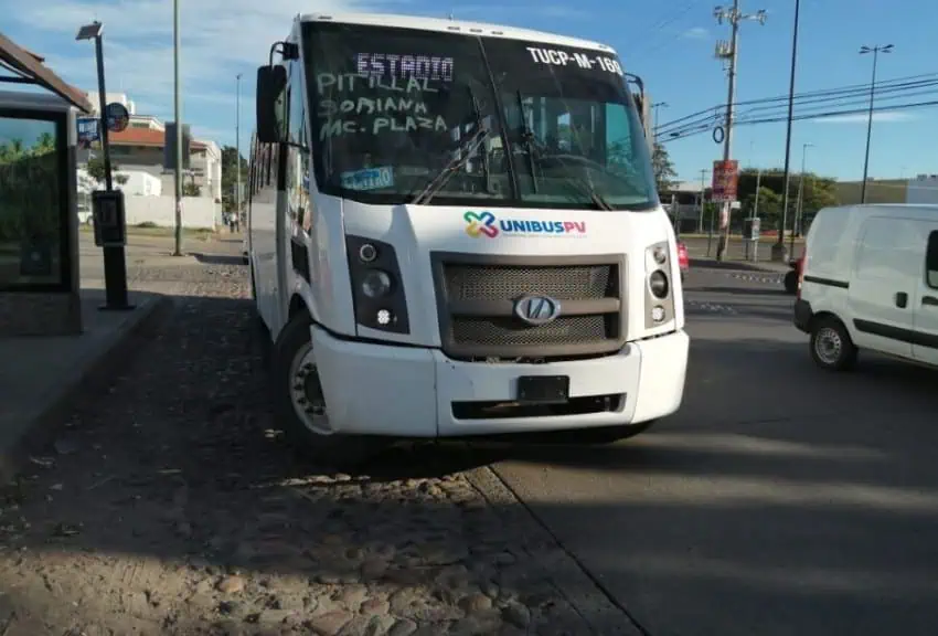
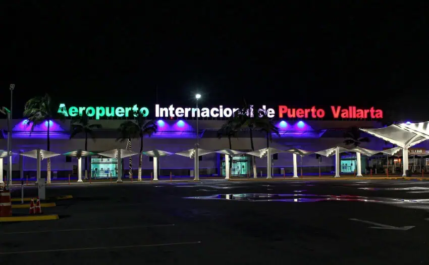
Let’s talk about the airport. If you’re traveling light, skip the pricey taxis and head to the pedestrian bridge outside the terminal. Locals gather on the airport side to catch buses heading south. Avoid any bus that says Pitillal unless you’re in the mood for a scenic detour through Vallarta’s backstreets.
If you do need to take a taxi, use the pedestrian bridge to cross the highway, where you’ll find a string of yellow taxis. These taxis are often cheaper than the ones you will get directly at the airport.
If you’ve got time and no agenda, hop on any bus and stay aboard until the end of the line. For 10 pesos each way, you’ll be treated to a real slice of local life. It may not be glamorous, but it will be memorable.
Finding your route
A website called RutasVallarta.com claims to help you search routes by destination, but in my experience, the map is often broken. Google Maps does a much better job of telling you where to go. You can also ask a local.
You can find the routes laid out on the website if you visit rutasvallarta.com/rutas, but you’ll have to know the start and end point of the entire line to find where you want to go. It’s much more efficient to use Google Maps.
Once you get the hang of the buses, they’re a fantastic way to explore the city like a resident. And, fortunately, the city isn’t so big that you end up very far away from where you want to be. If all else fails, Uber is always just a tap away.
Meagan Drillinger is a New York native who has spent the past 15 years traveling around and writing about Mexico. While she’s on the road for assignments most of the time, Puerto Vallarta is her home base. Follow her travels on Instagram at @drillinjourneys or through her blog at drillinjourneys.com.