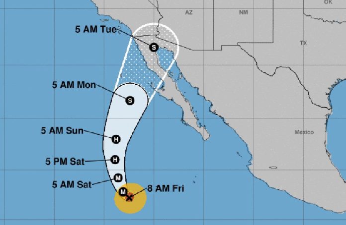
A category 4 hurricane in the eastern Pacific Ocean is forecast to make landfall as a tropical storm next week on the Baja peninsula.
The United States National Hurricane Center (NHC) said at 10:00am CDT that Hurricane Rosa was located about 1,105 kilometers southwest of the southern tip of the peninsula. Maximum sustained winds were 220 kilometers per hour.
The NHC forecasts that Rosa, which is currently moving northwest, will make a swing to the north by Saturday night followed by a turn to the north-northeast early next week.
The storm has already weakened and a steady weakening trend is expected to begin Saturday night.
There are no coastal watches or warnings in effect, but Mexico’s National Meteorological Service forecasts intense rain for Baja California and Sonora after the storm crosses the peninsula into the Gulf of California.
It said Rosa is forecast to make landfall as a tropical storm on the west coast of Baja California on Monday.
Because the soil is already saturated with water due to recent heavy rains, the weather office warned of the danger of rivers overflowing their banks, landslides and flooding.
Large swells are also predicted on some portions of the coast of southwestern Mexico and the southern Baja peninsula.
Mexico News Daily
