
")
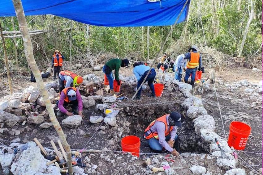
Archaeologists have uncovered 83 atypical wall-like structures in the southeastern state of Quintana Roo that are being described as akin to a pre-Columbian Google Maps.
The walls — a dry-laid limestone construction known as “albarrada” that’s typical across the Yucatán Peninsula — are located in the municipality of Chumpón within a section of Maya ruins uncovered in September 2022 during the construction of Section 6 of the Maya Train, which links Chetumal to Tulum.
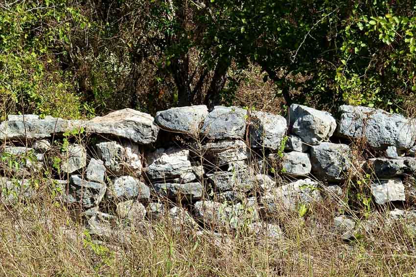
Fabián Gutiérrez Gómez, the archaeologist heading the dig, says that the walls’ unusual L-shaped design and atypical location have led his team to develop “a hypothesis that, perhaps, in this specific case, [the walls] were used as a kind of pre-Columbian ‘Google Maps’ that allowed inhabitants to determine their position in the region.”
This hypothesis is bolstered by the fact that the walls do not appear to serve any structural purpose other than delimiting areas such as cropland and residential zones.
Gutiérrez said in a National Institute of Anthropology and History (INAH) press statement that initial discoveries at the site included more than 200 archaeological monuments, including two terraces, two cisterns and 53 foundations, as well as the walls.
INAH has dated the walls — roughly 1 meter (3.3 feet) in width and 70 centimeters (2.3 inches) in height — to the Early Classic period of the Maya (A.D. 250–600). The walls range from 5 meters to 400 meters (16.4 to 1,312 feet) in length.
INAH noted that demarcation walls are not a feature previously identified with Maya settlements. However, they are so simple and effective that they are still used in contemporary rural architecture in Mexico.

A few of the walls were discovered near foundations, requiring more theoretical analysis to dismiss the notion that they — or at least some of them — were not simple property boundaries. The idea that the walls are demarcation points — the “Google Maps” theory — is also supported by the fact that most of the 83 walls were found nowhere near archaeological ruins.
The discovery has allowed archaeologists to theorize about the lifestyle of the Classic Maya with regard to space use, communal activities and social organization, Gutiérrez said.
INAH also reported additional findings at the Chumpón site, including 218 bags of ceramics, three metates (grinding stones) and two flint knives.
The Chumpón location is among 29 archaeological sites that have been uncovered during the Maya Train’s construction. According to INAH head Diego Prieto, the rescue work conducted as a result of the railway project has yielded more than 1.4 million ceramic fragments and over 50,000 movable and immovable objects, including palaces and architectural structures.
With reports from La Jornada Maya

")