Helene strengthened into a Category 1 hurricane Wednesday morning, as it moved past the Quintana Roo coast toward the Gulf of Mexico.
At 9 a.m. CST, the eye of the hurricane was centered 70 km northeast of Cancún and 135 km north-northeast of Cozumel, moving north-northeast at 17 km/h, according to the National Meteorological Service (SMN). Helene has sustained winds of 130 km/h with gusts of up to 155 km/h.
A hurricane warning is in effect from Cabo Catoche to Tulum, Quintana Roo, including Cozumel. Meanwhile, a tropical storm warning is active from Lagartos, Yucatán, to Cabo Catoche, Quintana Roo.
The SMN warned of wind gusts of up to 110 km/h on the eastern coast of Yucatán and Quintana Roo, waves of three to five meters high and the possible formation of waterspouts. The coast of Campeche could experience wind gusts of up to 60 km/h.
Helene brought torrential downpours (150-250 mm of rainfall) to Quintana Roo and Yucatán, and heavy showers (50-75mm) to Campeche on Tuesday. The United States National Hurricane Center (NHC) warned of “potentially significant flooding across the northeastern Yucatán Peninsula into early Thursday.”
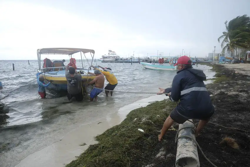
Weather authorities recommended that Yucatán Peninsula residents and marine vessel operators take extreme precautions and pay close attention to Civil Protection alerts and recommendations.
11AM EDT Sep 25: #Helene becomes a Hurricane. Helene is expected to bring life-threatening storm surge, damaging winds, and flooding rains to a large portion of Florida and the southeast U.S. Make sure to stay up to date with the latest forecast as we move throughout the event at… pic.twitter.com/aiDCNlravO
— National Hurricane Center (@NHC_Atlantic) September 25, 2024

Helene formed over the Caribbean Sea on Tuesday morning and quickly grew in strength, fueled by warm waters off the Gulf Coast.
The slow moving giant is expected to gain speed and reach a size of nearly 700 km across on Thursday. Since 2000, there have been only four named storms that grew to be as large as Helene is predicted to become. Helene is forecast to reach Category 2 strength Wednesday evening around 6 p.m. and Category 3 strength Thursday morning around 6 a.m., the SMN reported.
The storm is generating tropical storm conditions in Cuba, with hurricane conditions possible within the hurricane watch area, the NHC reported. In the United States, residents of northern Florida and southern Georgia are bracing for hurricane-force winds on Thursday with a substantial storm surge (over three meters in some areas) expected to cause flooding along Florida’s western coast.
Meanwhile on Mexico’s Pacific coast, John, which had weakened into a tropical depression after hitting Guerrero as a Category 3 hurricane on Tuesday, moved back out to sea and is strengthening again. Tropical Storm John is currently 170 km south of Zihuatanejo, Guerrero, with sustained winds of 65 km/h.
With reports from El Universal and Meteored