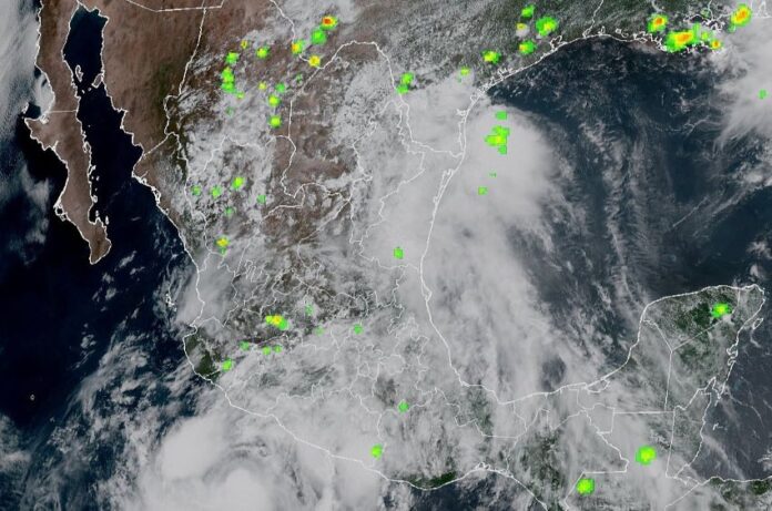
While Tropical Depression Barry continues to dump heavy rains on Mexico’s northern Gulf states, on the Pacific side, Tropical Storm Flossie is expected to rapidly intensify into a hurricane and skirt the west coast over the next few days.
At 9 a.m. on Monday, Flossie was centered about 160 miles (255 kilometers) south of Zihuatanejo, Guerrero, and was moving northwest at 10 mph (16 kph). It is not forecast to make landfall in Mexico but will cause significant rainfall in Michoacán and Colima.
Seguimos muy pendientes del desarrollo de la tormenta tropical #Flossie 🌀🌧️ De acuerdo con el último informe de la @conagua_mx, el centro de este sistema se encuentra a 280 km al sur de Zihuatanejo y continúa desplazándose hacia el noroeste, provocando lluvias torrenciales en… pic.twitter.com/GWjzFNqAMg
— Evelyn Salgado Pineda (@EvelynSalgadoP) June 30, 2025
Mexico’s National Meteorological Service issued a Tropical Storm Warning for Mexico’s west coast from Punta San Telmo, Michoacán, to Playa Perula, Jalisco, just north of Manzanillo, Colima, the country’s biggest Pacific coast port.
A Tropical Storm Watch is in effect from Zihuatanejo, Guerrero, northeast of Punta San Telmo and from Cabo Corrientes, Jalisco, south to Playa Perula.
The states of Jalisco, Nayarit, Guerrero and Oaxaca can also expect intense rains.
Tropical Storm Barry made landfall just south of Tampico, Tamaulipas, early Monday as a but quickly dissipated.
The remnants of the storm are expected to produce rainfall totals of 8 to 13 cm across portions of the states of San Luis Potosí and Tamaulipas through today, the Miami-based National Hurricane Center (NHC) reported. With possible isolated maximum totals of 20 inches, this rainfall may produce life-threatening flooding and mudslides, the NHC said, especially in areas of steep terrain.
30/06/2025
06:15 horas🌀 #Barry se disipó a las 03:00 horas de hoy a unos 160 km al noroeste de #Tampico. Sin embargo, se espera que, en las próximas 24h sus remanentes continúen ocasionando lluvias fuertes en #Tamaulipas, #SanLuisPotosí y el norte y montañas de #Veracruz. pic.twitter.com/JtSPCaWKSD
— Meteorología SPCVer (@spcver_met) June 30, 2025
Barry formed on Sunday and was the second named storm of the Atlantic hurricane season, which started on June 1 and runs through Nov. 30.
Andrea, the first named tropical storm of the 2025 Atlantic hurricane season, dissipated on June 24 just hours after forming in the middle of the Atlantic Ocean earlier that morning, the NHC said.
Forecasters expect 2025 to be an above-average season in the Atlantic, with 13 to 19 named storms. Last year, there were 18 named storms, 11 of which became hurricanes and five of those became “major” hurricanes (Category 3, 4 or 5 on the Saffir–Simpson scale).
The Eastern Pacific hurricane season began on May 15 and has featured five tropical storms already, including Erick, which hit Mexico’s West Coast as a Category 3 hurricane.
With reports from The Associated Press, N+, El Economista, The New York Times and El Universal
