After battering the states of Guerrero and Oaxaca earlier this week, Tropical Storm John strengthened back into a hurricane early Thursday after drifting out over the Pacific a day earlier.
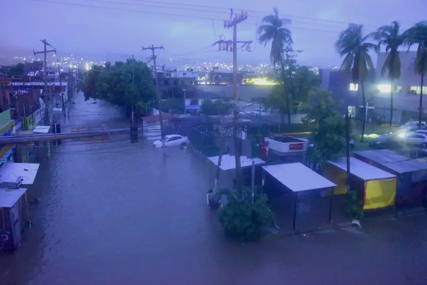
John is now poised to slam into the Mexican mainland again, threatening communities along the Pacific coast after causing floods and landslides that killed at least five people.

A U.S. National Hurricane Center (NHC) advisory published at 9 a.m. CST (and updated at 12 p.m.) cautioned that “Hurricane John is producing catastrophic life-threatening flash flooding and mudslides over portions of southern Mexico.”
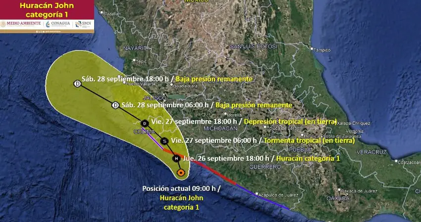
The NHC forecast John’s center will approach and move along the coast of southwestern Mexico and head inland later Thursday.
As of Thursday morning at 10 a.m., Mexico’s national weather agency (SMN) forecast Hurricane John will make landfall between Aquila, Michoacán and Tecomán, Colima (60 km south of Manzanillo, Colima) by Thursday night or early Friday morning.
There is a hurricane warning in effect from Tecpan de Galeana, Guerrero to Punta San Telmo, Michoacán, and a hurricane watch in effect from west of Punta San Telmo to Manzanillo.
#John has reformed off the coast of Mexico and is likely to restrengthen before making another landfall over Mexico, this time further up along the eastern Pacific coastline toward Manzanillo. pic.twitter.com/d2vBKsw6Cx
— Zoom Earth (@zoom_earth) September 26, 2024
Maximum sustained winds were reported to be hovering near 120 km/h with higher gusts. The NHC bulletin said “hurricane-force winds extend outward up to 10 miles (20 km) from the center and tropical-storm-force winds extend outward up to 140 miles (220 km).”
The NHC said John is expected to strengthen until the center moves along the coast or inland, a situation that should cause the storm to weaken to a tropical depression some time Friday, though it will continue drenching the Pacific coast through Saturday.
The strength and breadth of John has been producing heavy rains all along the Pacific Coast. An early morning bulletin issued by the SMN forecast extraordinarily heavy rains for Guerrero and Oaxaca (more than 250 mm), torrential rains in western Chiapas (150-250 mm) and intense rains in Michoacán (75-150 mm).
The SMN said the storm’s impact would also be felt in Puebla and Veracruz (75-150 mm) as well as in Mexico City, México state and Morelos (50-75 mm).

After coming ashore in Guerrero as a Category 3 hurricane on Monday night, John weakened to a tropical storm and lingered in the coastal mountains, impacting major cargo ports and shutting local airports. Reuters reported that John also cut power to tens of thousands and littered roadways with uprooted trees and fallen electricity posts.
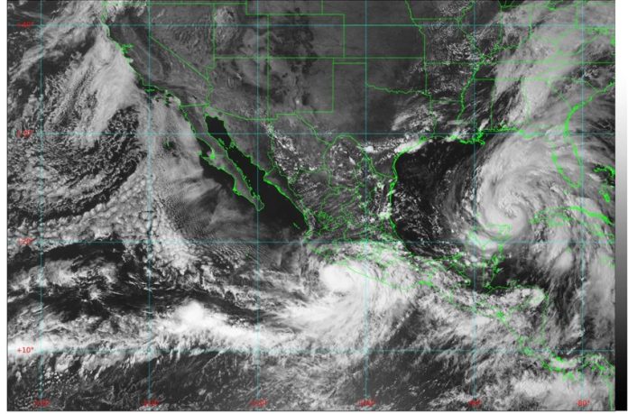
Meanwhile, the Yucatán Peninsula in southeastern Mexico, saw Helene — a Category 2 hurricane — dump rain on the states of Quintana Roo, Campeche and Yucatán.
Helene is now moving away from the Mexican coast as it heads north towards the U.S. Gulf Coast, where it is anticipated to make landfall in Florida on Thursday night.
With reports from The New York Times and Reuters
