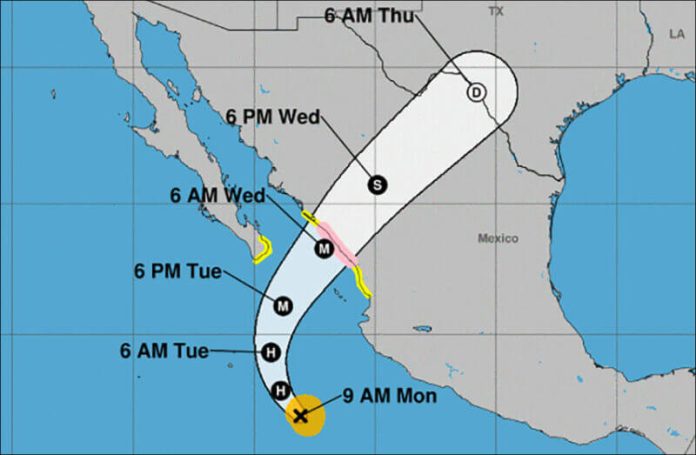
A rapidly strengthening tropical storm in the eastern Pacific has triggered a hurricane watch between Bahía de Tempehuaya and Escuinapa, Sinaloa.
As of 10:00 a.m. CDT on Monday, Tropical Storm Pamela was located 440 kilometers southwest of Playa Pérula, Jalisco, and 735 kilometers south-southwest of Mazatlán, producing sustained winds of up to 100 kmh, said the national meteorological service. It was moving to the northwest at 13 kmh.
The U.S. National Hurricane Center predicts that Pamela will become a hurricane by Monday night and a major hurricane before it reaches the Mexican coast. The storm is expected to pass south of the southern tip of the Baja Peninsula Tuesday night or early Wednesday and make landfall in Sinaloa on Wednesday morning.
Very heavy rains are forecast for Jalisco, Nayarit and Sinaloa.
A tropical storm watch is in effect for north of Bahía de Tempehuaya to Altata, Sinaloa, from south of Escuinapa to San Blas, Nayarit, for the Islas Marías and from Los Barriles to Cabo San Lucas in Baja California Sur.
Mexico News Daily
