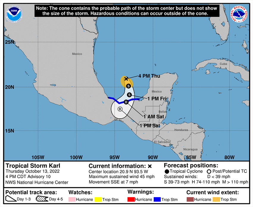
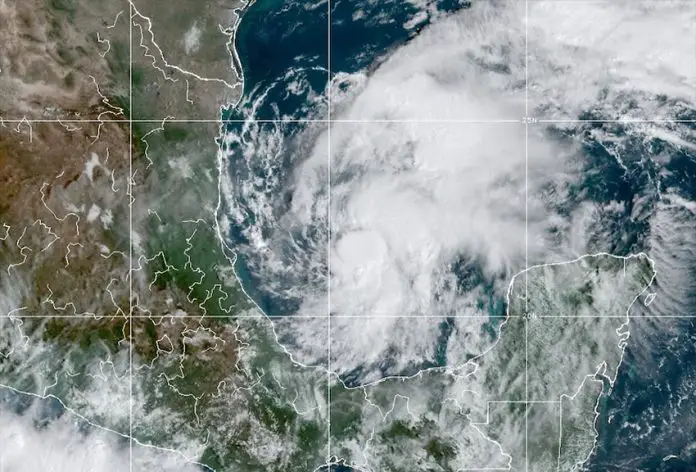
Tropical Storm Karl is on track to make landfall in Tabasco or Veracruz late Friday or early Saturday.
The storm was 315 kilometers north-northeast of Coatzacoalcos, Veracruz, at 4 p.m. Central Time on Thursday and moving south-southeast at about 11 kilometers per hour, the United States National Hurricane Center (NHC) said in an advisory.
Karl, the 11th named storm of the Atlantic hurricane season, has maximum sustained winds of 75 km/h with higher gusts, the NHC said.
A tropical storm warning is in effect for Alvarado, Veracruz, to Ciudad del Carmen, Campeche.

“Karl is expected to turn southward or south-southwestward over the Bay of Campeche on Friday, and this motion should continue through early Saturday,” the NHC said.
“On the forecast track, the center of Karl should reach the coasts of Tabasco or Veracruz states … within the warning area late Friday night or early Saturday.”
Mexico’s National Meteorological Service (SMN) said that Karl would bring intense rain to parts of Veracruz, Tabasco, Campeche and Chiapas, and very heavy rain to portions of Puebla and Yucatán.
The rain could cause flooding and landslides, the SMN said. Similarly, the NHC warned of the risk of flash flooding and mudslides, and forecast falls of up to 10 inches (25 centimeters) in some areas.
“Swells generated by Karl are expected to affect the … [Gulf of Mexico] coastline for the next couple of days,” the hurricane center added. “These swells are likely to cause life-threatening surf and rip current conditions.”
The Atlantic hurricane season began June 1 and runs through November 30. Before Karl came hurricanes Danielle, Earl, Fiona, Ian and Julia, and tropical storms Alex, Bonnie (which became a hurricane in the Pacific Ocean), Colin, Gaston and Hermine.
Mexico News Daily
