

Cold front 19 will bring heavy precipitation to much of Mexico over the next few days, with snow forecast in high-altitude areas of the north and heavy rains in the south and center regions of the country.
According to the National Meteorological Service (SMN), the mass of cold air is moving over the north and east of the country this Tuesday, interacting with subtropical low-pressure bands at its southern edge to bring very heavy rains (50-75mm) to Campeche, Chiapas, Puebla, Quintana Roo, Tabasco, Veracruz and Yucatán.
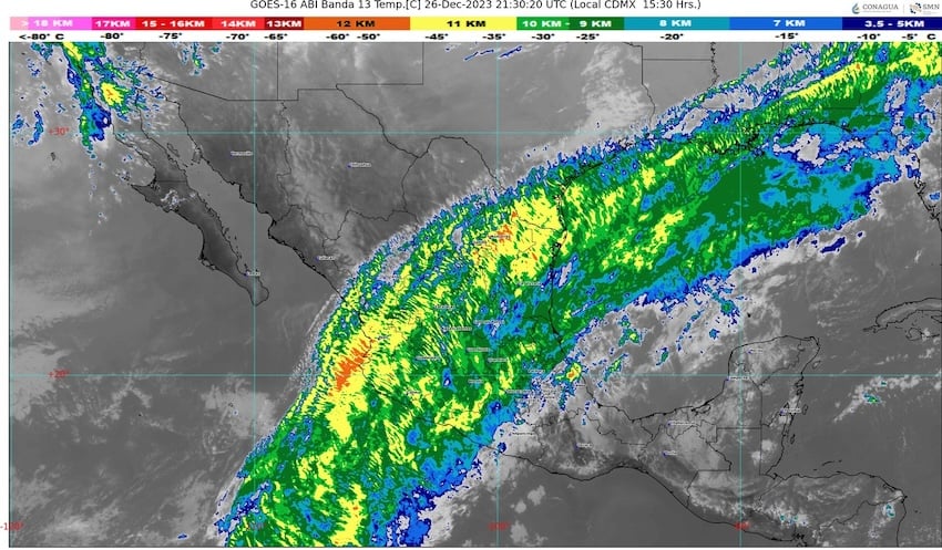
Heavy rains (25-50mm) are also predicted for México state, Colima, Guanajuato, Guerrero, Hidalgo, Jalisco, Michoacán, Oaxaca, Querétaro and San Luis Potosí; scattered showers are likely in Mexico City, Morelos, Tamaulipas, Tlaxcala, Nayarit and Nuevo León.
The SMN warns that the heaviest rains could be accompanied by hail, lightning and strong winds, and may cause flooding in low-lying areas.
Meanwhile, the cold front will cause snow and freezing fog across mountainous areas of the north, particularly in the states of Baja California, Chihuahua, Durango and Sonora, where temperatures could drop as low as -10 degrees Celsius. Temperatures around freezing are also predicted for high-altitude areas across the center and north of Mexico, with snowfall on peaks over 4,200 meters, such as Nevado de Toluca and Popocatépetl.
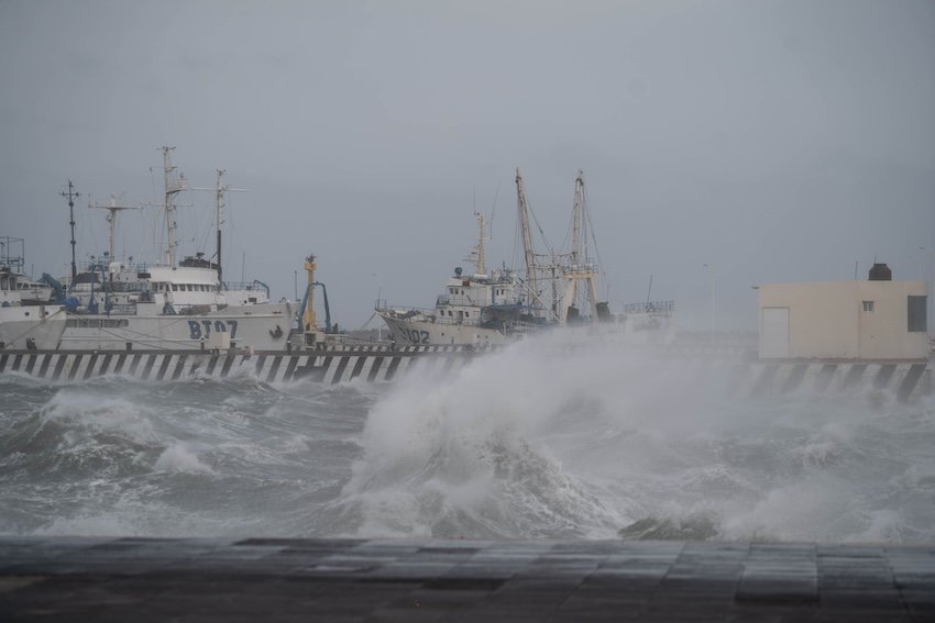
Wind gusts of up to 60 kilometers per hour and waves 1-3 meters high are predicted for the Gulf of California, with potential tornado formation in most of Mexico’s western and central states.
Meanwhile, higher temperatures are predicted for the south of the country, with maximums of 40 degrees Celsius on the coasts of Chiapas, Guerrero, Michoacán and Oaxaca, and 35 degrees Celsius in Campeche, Quintana Roo and Yucatán.

The SMN predicts that similar conditions will continue over at least the next three days, with the “northerly event” in the northwest extending south and east to bring strong winds and high seas to the coasts of Tamaulipas and Veracruz and the Isthmus of Tehuantepec.
By Thursday, wind gusts of up to 70 kilometers per hour and waves 1-3 meters high are predicted to develop around the Isthmus of Tehuantepec, and gusts of up to 50 kilometers per hour are forecast on the coasts of Tamaulipas, Tabasco, Campeche, Yucatán and Quintana Roo.
Similar conditions seem likely to continue over the first days of the new year, as cold front 20 slowly advances over the northern Gulf of Mexico.
Mexico News Daily