

More rain is expected for several parts of Mexico this week, according to weather forecasts by the National Meteorological System (SMN).
On Tuesday, a new tropical wave will move between the southeastern states of Quintana Roo and Yucatán, bringing heavy rain along the way. On Wednesday it will reach southern Oaxaca and Guerrero before extending to the Valley of Mexico, Puebla, Morelos and surrounding areas.
By Thursday, another tropical wave will enter the Yucatán Peninsula and move west between Friday and Sunday to the Valley of Mexico, the Southern Bajío, western Jalisco and Nayarit. Both waves are expected to become unstable and generate strong storms along their path.
Despite the rain, afternoons will continue to be hot in the northwest, north, northeast and the Yucatán Peninsula. In these regions, temperatures are expected to soar over 40 C in Baja California, Baja California Sur, Sonora, Chihuahua, Coahuila, Nuevo León, Tamaulipas and Campeche.
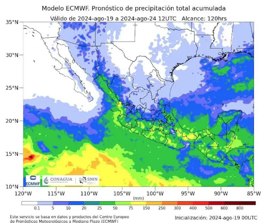
Rain forecast by state
Very heavy rains (75 to 150 mm): Sonora, Sinaloa, Nayarit and Jalisco.
Heavy rains (50 to 75 mm): Chihuahua, Durango, Colima, Michoacán, Guerrero, Oaxaca, Veracruz, Tabasco, Chiapas, Campeche and Yucatán.
Light rains (25 to 50 mm): Baja California Sur, Tamaulipas, San Luis Potosí, Puebla, México state and Quintana Roo.

Showers (5 to 25 mm): Baja California, Coahuila, Nuevo León, Zacatecas, Aguascalientes, Guanajuato, Querétaro, Hidalgo, Tlaxcala, Mexico City and Morelos.
Tropical Storm Gilma expected to dissipate
The SMN forecasts that Tropical Storm Gilma will evolve into a category 2 hurricane off the coast of Punta Eugenia, in the Baja California Sur municipality of Mulegé. At this time, Gilma poses no threat to the country and meteorologists expect it to dissipate by Saturday.
Meanwhile, the National Water Commission (Conagua) is monitoring three low pressure areas in the Pacific Ocean that could develop into tropical cyclones in upcoming days.
The low pressure area closest to mainland Mexico is south of the coasts of Colima and Jalisco. The likelihood of cyclone development is 70% in 48 hours and 90% in seven days. The second low pressure area is southwest of the Baja California peninsula, with a 70% probability of becoming a cyclone in seven days.
The third and farthest zone is likewise southwest of the Baja California Peninsula, with 20% probability of becoming a cyclone in the next week.
With reports from Meteored