Ciudad de México is the most populous city in North America, teeming with around 21 million inhabitants.
There couldn’t be much green there, you’d think, but, according to Peter Winckers of the Aztec Explorers hiking club in the capital, that assessment would be dead wrong.
“Believe it or not, 51% of Mexico City is still green, and nine of our favorite hikes are entirely inside the city limits,” says the Dutchman, who’s been living in the capital for over a decade.
Whether or not you are a hiker, Winckers claims that Mexico City is much more interesting than many other big metropolises.
“Originally, it started out as 21 little villages, which all grouped together into the monster that is now Mexico City, ” he said. “In fact, you could say we have 21 Barrios Mágicos inside the city limits [Magical Neighborhoods]. So our group started out doing walking tours inside the city. Then we got into hikes, and finally day trips.”
Winckers is the quality manager of a call center as well as the owner of a small travel agency in the capital.
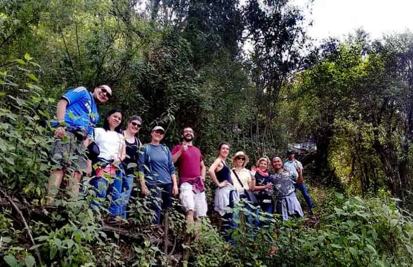
More than 13 years ago, he came to Mexico as a consultant, met his wife Lidia and never left. Lidia is a certified guide and organizes hikes for small groups of up to 12 people.
Below is a sample of their favorite caminatas (walks/hikes) in and around the big city.
Izta–Popo National Park
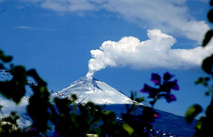
This park encompasses Mexico’s second highest peak, the active Popocatépetl volcano, along with the nation’s third-highest peak, Iztaccíhuatl volcano, which is dormant.
Popocatépetl’s peak, understandably, has a 7-kilometer-wide no-go zone surrounding it. But trekkers might spend two days on the trail that will take you atop Iztaccíhuatl. Winckers likes to drive from the city about two hours to Iztaccíhuatl and make a photo stop at Paso de Cortés, the pass between Popo and Itza named after conquistador Hernán Cortés.
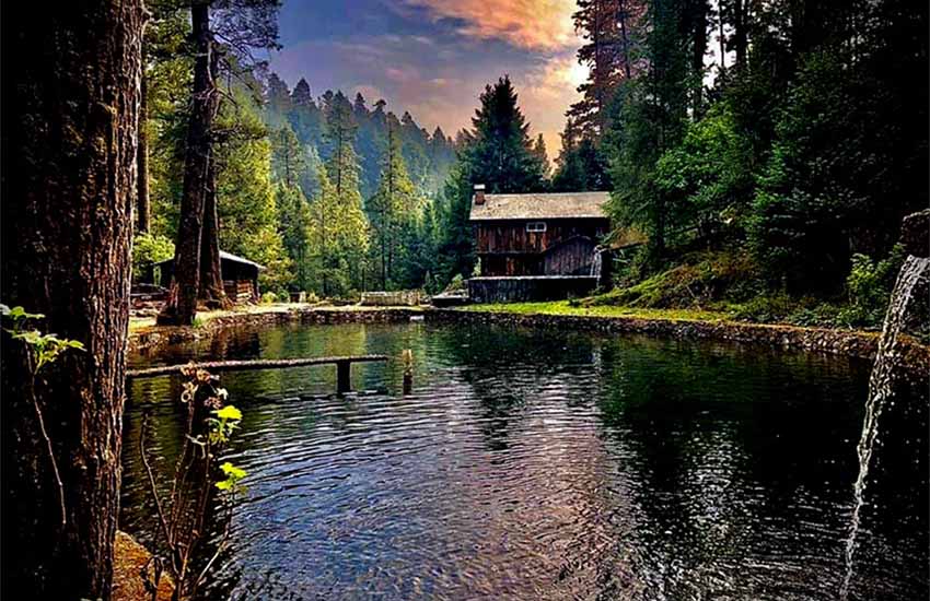
“Once you’re up here,” says Winckers, “you can do an easy hike of about one hour to get to a place where they have some of the best quesadillas in Mexico, which are made with blue-corn tortillas. So, normally, we have a light breakfast here and then we walk two to three hours up Iztaccíhuatl. It’s really amazing because it’s always different, and sometimes, of course, you’ll be walking in the snow. There’s a waterfall in this area, a small lake and a restaurant serving the freshest trout imaginable, and there are beautiful cabins up there for people who want to spend the night. It’s one of my favorite places.”
Note that you can reach the Cortés Pass in a normal car. Because this is a very big park, having wheels is a big advantage.
“You have to plan your trip well,” adds Winckers. “You need to go on a nice, sunny day, otherwise you won’t even see the volcano. But on a cloudless day, you have beautiful views of Popocatépetl.”
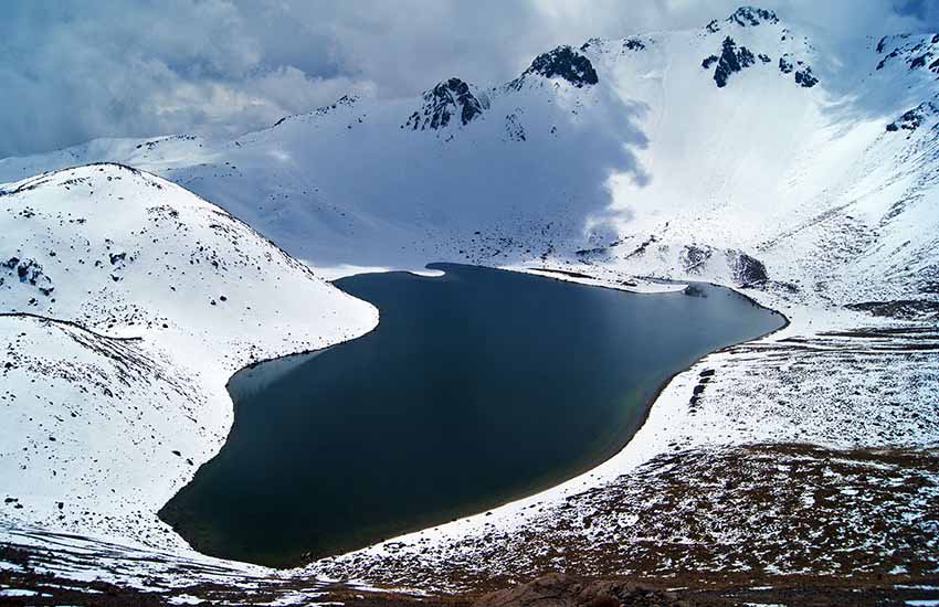
Nevado de Toluca
This is Mexico’s fourth highest peak and another national park. It’s a three-hour drive from Mexico City right up to the rim of the 1.5-kilometer-wide caldera at the top. “You are at around 4,000 meters altitude,” says Winckers. “There are two beautiful lakes, Laguna del Sol and Laguna de la Luna, inside the crater and you can hike around them.”
Cumbres del Ajusco National Park
This is another dead volcano, situated towards the south end of Mexico City, which rises to a height of 3,930 meters. The word ajusco means “source of waters.” Its springs are said to be the source of the Lerma River.
“Here you can have a delightful walk of about six hours,” says Peter Winckers, “and all the time you are completely inside the city limits. So, if someone asks what’s the highest point in Mexico City (trivia question), here you have the answer.”
Ajusco has two peaks you can climb: Pico del Águila and la Cruz de Márquez.
“The trails leading to both are beautiful,” says Winckers, “with amazing views. On one side you see the sprawl of Mexico City, and on the other side, beautiful views of the hills and volcanoes to the south.”
Teuhtli Volcano
This is a shield volcano located at the southern edge of the city. You start your walk on flat land surrounded by farmers’ fields.
“In October or November, you will see lots of amaranth: beautiful, high, red plants with yellow flowers,” says Winckers. “We have a local guy who lives there. He knows all about processing the amaranth into little bars containing chocolate, called alegrias [happiness].”
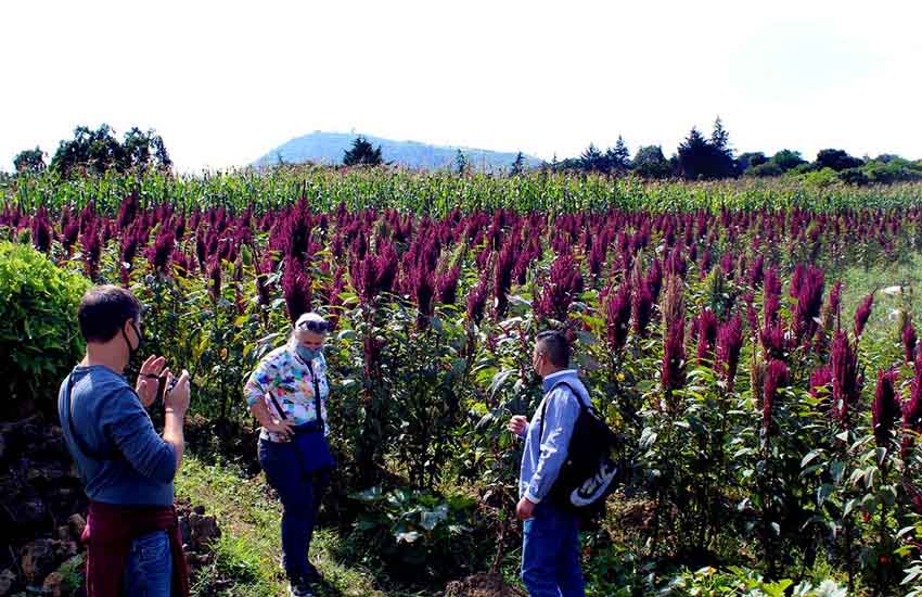
In bright contrast, the other side of Teuhtli volcano is completely covered with nopal cacti. Reaching the top is an unforgettable experience.
“You are walking up a steep slope covered in very loose volcanic ash, so you tend to move one meter up and two meters down, but our guide shows you his technique for managing this without slipping back,” says Winckers. “Once you get to the top, you can walk all around the crater rim, where you will realize just how big Mexico City is.”
“At this point,” he says, “you are 2.5 hours south of the zócalo. In the distance, you can see the canals of Xochimilco, and on the other side, a patchwork quilt of agricultural fields: 4,000 different shades of green.“
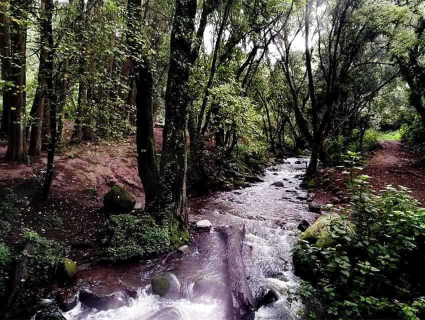
Los Dinamos
Here you’ll find Mexico City’s only living river. This area is called Los Dinamos because in the past, there were factories along the stream, with dynamos generating electricity.
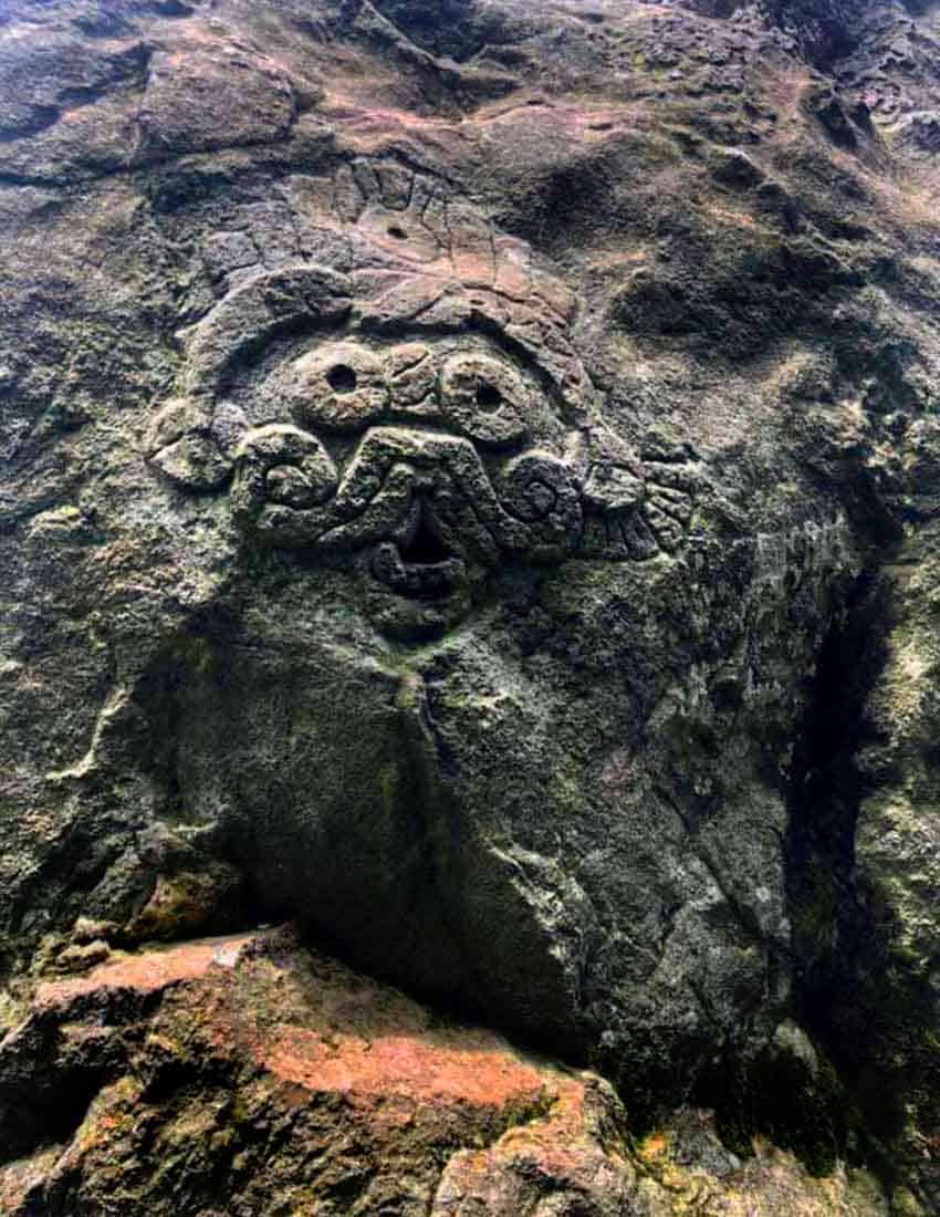
Today, the factories are gone and it’s a beautiful walk along the river up to a great lookout point. Winckers recommends you go with a guide: “There are quite a few trails in this area, and you don’t want to miss the best ones. Also, if you have a guide, he can take you to a cave here with pre-Hispanic petroglyphs depicting snakes and the [Mesoamerican] god Tlaloc.”
- For information on guided tours to these and many other great sites, see Aztec Explorers’ page, Hiking in and around Mexico City.
The writer has lived near Guadalajara, Jalisco, since 1985. His most recent book is Outdoors in Western Mexico, Volume Three. More of his writing can be found on his blog.