I recently learned that one of my neighbors, Javier Vergara-Blanco, was carrying out a most unusual project inside the huge Primavera Forest which lies adjacent to the city of Guadalajara.
“It has something to do with helping to solve erosion problems caused by heavy rainfall,” I was told. “You ought to interview him.”
Well, I contacted Vergara-Blanco, pulled out my recorder and said, “Tell me something about yourself.”
“OK,” said my neighbor in excellent English. “I was born in the town of Tlaquepaque, just east of Guadalajara. I got a B.A. in computer engineering, worked for IBM for several years doing systems development and analysis and then got an M.A. in applied economics at the University of Michigan at Ann Arbor. After that I began a Ph.D. program in information technology at the University of Guadalajara.”
“Wait a minute!” I interrupted. “How did the background you just outlined ever lead you to work on solving rainfall-related problems in a forest?”
Vergara-Blanco then told me he had also spent some years in Monterrey carrying out the financial evaluation of investment projects, meaning that he had to predict what would probably be the outcome of such projects.
“And then,” he added, “I got a job at the national headquarters of Conafor [the National Forestry Commission] and worked for them for seven years.”

At Conafor, Vergara-Blanco used his skills to have the forest-related subsidy programs evaluated in order to support the development and conservation of national forests. “After that I got a job working with people doing applied geophysics and I learned about laser technology for precision mapping not only of the surface of a forest but also of what lies beneath the surface: is it rocky? Sandy? Full of holes? Is there water there already?”
During his years with Conafor, Vergara-Blanco developed a soft spot for forestry and when he began to think about a project for his Ph.D., he decided to “do my bit for forests.”
For the next five years, Vergara-Blanco applied his computing skills to create a program which simulates a storm event on any forest surface and could be instrumental in predicting the effects of forest fires or tree clearing on flooding.
As a model, he used an actual 100-hectare section of the Primavera Forest: a big hill cut by ravines located 10 kilometers west of Guadalajara. New, laser-based technology is used to overlay a three-dimensional mesh on this surface. The program takes into account not only the surface topography and rugosity (roughness), but the soil infiltration capacity as well.
It simulates rainfall and shows how much of this water is retained and how much becomes runoff. It can also show what a storm does to the very same area after a forest fire has swept through it, or tree removal has occurred.
All of this became much clearer when my neighbor said, “Look, let me show you a simulation of an actual event, a particularly bad storm which hit my hills in the Primavera Forest on June 27, 2016. The storm lasted 92 minutes with precipitation of 50 millimeters, which is considered violent rain.”
On the computer screen I saw a three-dimensional mesh representation of the hill complete with ravines. As minute after minute ticked off at the top of the screen, blue shading appeared, showing water accumulation, movement and flooding.
With only a click, Vergara-Blanco switched from this animated video of rain and runoff to a second video showing the same hill protected by what forestry people call “land remediation controls” to minimize rainfall runoff and to maximize rainfall infiltration.
These controls could take the form of terraces, retaining walls, or strategically placed ditches, and their spatial distributions are designed by algorithms. Algorithms may seem esoteric, but Vergara-Blanco’s animation, which shows subsequently more effective spatial distributions, is mind-boggling.
“This is actually artificial intelligence at work,” he told me. “For this optimization test, 355 plans are generated, each plan including 100 alternatives. After each plan, comparisons and judgments are made and yet more solutions are proposed. The computer program can aim solely at minimizing overland flow volume and velocity, preventing or reducing erosion, or principally at infiltration: getting the rainfall into the subsurface so the water stays on the hill instead of flowing elsewhere. Finally, at the end, the very best proposals are presented.”
[soliloquy id="66418"]
In practical terms, this means that a ranger could run Vergara-Blanco’s program to find out the best land-control spatial distribution for a target area, and send out a crew to build structures of predefined sizes, which they can locate out in the forest by GPS. This could minimize the chances of flood, or erosion damage, that would otherwise occur perhaps several months later when the rainy season arrives.
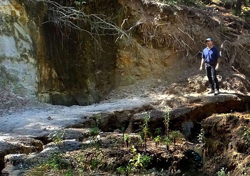
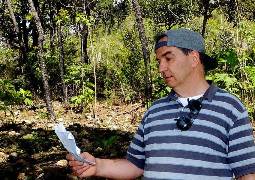
The hill shown in the two videos mentioned above is located within the boundaries of the Primavera Forest and is visible from the community where I live. “I last visited that hill four years ago when I began my thesis,” Javier told me one day. “I would like to take another look at it, but it’s rather difficult to access.”
By chance I knew of a trail that skirts the southern side of this hill and I easily found friends willing to accompany us on a reconnaissance of his study site.
“On this hike,” said the computer programmer, “I was impressed by the great damage wreaked by erosion alongside the road and paths leading to the study area, but when we began to climb the hill, we found no erosion. I was happy to see how healthy the tree cover was, and I was delighted to see once again the watershed I had been analyzing with so much detail, the watershed clearly shown in the computer model of this hill. I could also verify first-hand that the soil texture is prone to sediment loss. It is therefore very likely that significant erosion will occur here if a high severity wildfire, or tree clearance, takes place.”
“This corroborates the conclusions shown in the thesis and makes the distribution of land remediation works all the more relevant.”
Javier Vergara-Blanco’s thesis project was inspired by the work of Jesús León Santos, an indigenous Mixtec farmer who, at the age of 18, decided to change the landscape of his homeland, the barren, dusty Mixteca Alta in Oaxaca, which is “one of the most arid places on earth” thanks to the deforestation and grazing introduced by the conquistadores.
To remedy this, León employed terracing techniques used by his pre-Hispanic ancestors and when the benefits were seen, more and more local people joined his organization, the Center for Integral Small Farmer Development in the Mixteca (CEDICAM).
Over a period of 25 years, León and his friends managed to bring erosion under control and to plant around four million native species of trees that did well in the local climate. They also developed an agricultural system that did not require pesticides.
“Today,” says the organization ProMéxico, “the miracle has happened. The Mixteca Alta is restored. It is green once again. Aquifers have filled up with more water. There are trees and crops and people remain to live on their land.”
By 2008 Jesús León had restored 8,000 hectares of previously barren land and was awarded the Goldman Environmental Prize, the equivalent of the Nobel Peace Prize for work in ecology.
Javier Vergara-Blanco’s doctoral thesis is entitled Forest rainfall infiltration and runoff: a simulation and optimization system and is written in English.
Vergara-Blanco now hopes to find financing to continue his research. He would like to add the removal and redepositing of soil during storms to his simulation and optimization system and develop it into a program that provides additional support for reforestation projects, which woodland conservationists could adapt to their particular needs.
The writer has lived near Guadalajara, Jalisco, for more than 30 years and is the author of A Guide to West Mexico’s Guachimontones and Surrounding Area and co-author of Outdoors in Western Mexico. More of his writing can be found on his website.