In colonial Mexico, when a Spanish settler sought to build a ranch near a former Aztec aqueduct, the local indigenous community feared that the livestock would pollute the water supply and a crisis emerged.
To defend their land, they turned to a resource increasingly used again today by indigenous people throughout colonial Mexico: maps of the territory in question.
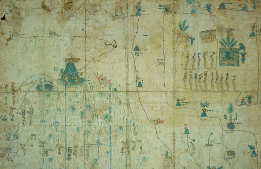
Created by trained cartographers or tlacuiloque, these land-grant maps became a valuable document in court proceedings to determine whether land would be issued to a petitioner.
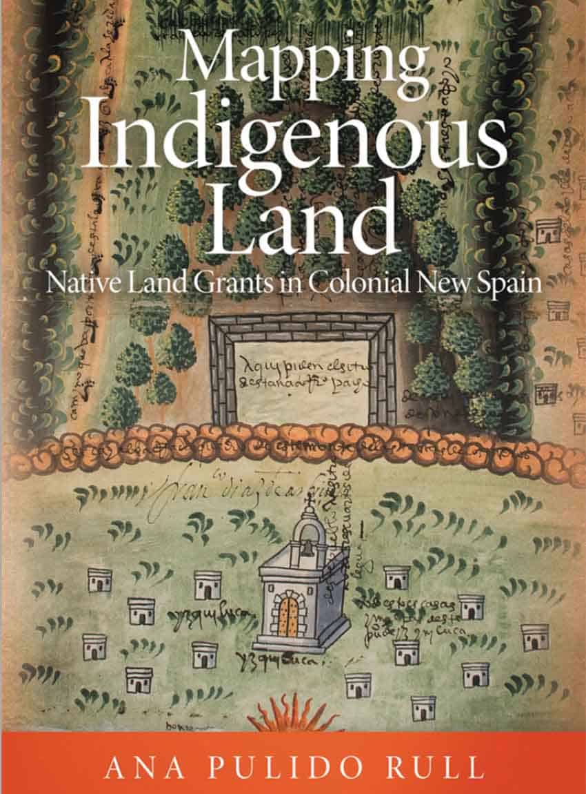
Their narrative is getting increased attention thanks to a new book, Mapping Indigenous Land, by Ana Pulido Rull, a professor of art history at the University of Arkansas.
“They are a really great combination of geographic knowledge, art and mapmaking,” she said in a Zoom interview, noting, “Sometimes they were hung on walls for display.”
“There was a very significant tradition of mapmaking in precolonial Mexico before the Spanish arrived,” Pulido Rull said, citing over 1,000 native maps, including from the colonial period. “Land-grant maps, the subject of my book, have not really been published before. Only a couple of books have been written [about them] before.”
She examined over 200 surviving maps from the 16th and 17th centuries in the national archives in Mexico City, where she is originally from.
“It was the best part of my research,” she said. “You get to open maps, touch the paper, see the pigments. They’re really beautiful … I had never seen any. They had not been published. It was a really fascinating experience.”
Although it was unusual to work in a space that had once been a prison, where documents are kept in former cells, Pulido Rull kept coming back. She studied the maps up close, using infrared cameras and ultraviolet light.
She calls the tlacuiloque “very artistic, very intelligent men and women,” noting that they were “trained as painters in a really sophisticated way of representing space.”
These mapmakers could have created a simple diagram, a plain map with glyphs, she explained, but instead they “created pigments, designed a space; they had to create a composition, a color palette.”
That palette includes the cochineal red made from insect parasites of the nopal cactus, which found its way into the paintings of Titian and Rembrandt.
“It was amazing, the different pigments [the tlacuiloque] used,” she noted.
As she discovered, indigenous mapmaking in Mexico dates back to A.D. 700. During the Spanish conquest, indigenous maps proved invaluable against the Aztecs.
“Spanish soldiers used the maps to find their way,” Pulido Rull said.
After the conquest, Spanish settlers sought grants of land, often at the expense of the indigenous community. Yet, expropriation did not immediately follow a settler’s request.
Because of Spanish law dating back to the Middle Ages, there had to be court proceedings. Indigenous communities could present maps of the disputed area that showed its value to them.
“The Spanish government opened a window, a way for indigenous people to participate actively in debates over land,” Pulido Rull said. “Also, indigenous people worked very hard. They learned the laws. They were very smart [about] how to keep territory, preserve territory, in a very difficult situation.”
She called this “a very unusual moment in history,” adding, “The land grant process had its advantages and also its limitations … A group of people was able to request to negotiate or defend territory.”
In their maps, tlacuiloque combined indigenous techniques with European elements. They might keep the traditional image of footprints to indicate routes while incorporating aspects introduced from Europe such as shadowing and perspective.
These mapmakers included Náhuatl glyphs and place names but eschewed depicting sacred Aztec spaces like monoliths, perhaps out of the belief that this would have little impact on a colonial administration that favored their conversion to Catholicism.
The maps were part of a larger story of negotiation during this period.
“I think indigenous communities came together in a very strong way to defend their land,” Pulido Rull said. “It was much more than defending their land. They always stood up for their rights in court whenever necessary. They fought for their land in the same way we do today.”
This included such measures as using legal documents and witnesses. They also built “houses overnight,” Pulido Rull said, “to show the land was in use.”
The academic thinks that negotiation is the most important part of her book.
“It would have been very difficult for indigenous communities to keep their land if they were just opposed to a situation. They really learned how to negotiate.”
In an instance Pulido Rull highlights in her book, a land-grant map was used to contest a settler’s request to build a ranch next to a former Aztec aqueduct.
“It was very dangerous because animals like cows and goats would trample on the aqueduct, destroy [it],” Pulido Rull said. “Their feces and urine would pollute the water just like that. You don’t want a cow to pee in your water or destroy your agriculture. Everybody opposed it … It was not only about a community; the Spanish would not be able to drink the water either.”
A tlacuiloque depicted the territory in question, including the location of the proposed ranch, the source of water and the aqueduct.
In the end, however, this particular use of indigenous maps did not change the Spanish court’s mind. It granted the settler’s request.
“[This gives] an idea of how far the Spanish grants would go,” Pulido Rull said.
Collectively, several hundred thousand square feet of land were granted to Spaniards in such court proceedings during the 15th and 16th centuries, with under 400 square feet granted to indigenous people.
The environmental damage predicted for the aqueduct and its water supply reflected the ecological catastrophe of introducing new species such as cows, horses, pigs and goats — all which had no natural predators, as well as the required clearing of land.
“What you see is that the law in some cases was really a formality.” Yet, she added, “some indigenous families were able to keep their land. It gives you some … hope after reading so many terrible stories.”
Although indigenous cartography started to vanish after the colonial government began bringing in professional mapmakers from Europe, the land-grant maps have become an important legal document again.
“It has been going on since the Mexican Revolution,” Pulido Rull said. “In Mexico, these documents and images still have legal value.”
Indigenous communities, she noted, “travel all over Mexico looking for documents and maps. Today, the Mexican government still values [this] evidence as legal evidence.”
As she explained, maps from the 16th, 17th and 18th centuries can still be used to determine contemporary legal rights near a lake or pond. In some cases, indigenous families who kept their land through maps have passed it down through the generations through today.
“Even in the 21st century, indigenous communities still have a use for them,” Pulido Rull said. “People teach how to read the maps, for example … Certain towns still have their beautiful place names from Mesoamerica. Some elements still survive.”
Rich Tenorio is a frequent contributor to Mexico News Daily.