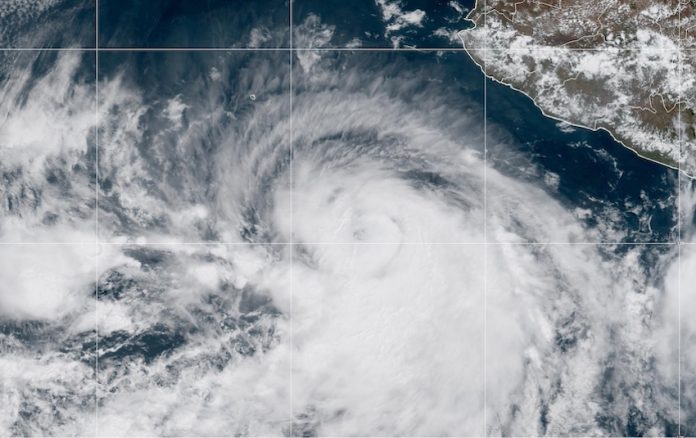
Tropical Storm Adrian was upgraded to a category 1 hurricane – the first named storm of the hurricane season in the eastern Pacific – bringing heavy rains to the western coast of Mexico.
The National Meteorological Service (SMN) reported on Wednesday morning the upgrade from a tropical storm to a category 1 hurricane, with maximum sustained winds of 120 to 150 km/hr. Gusts of 40 to 60 km/hr could hit coastal states, and waves may reach heights of up to three meters. While the hurricane is not predicted to make landfall in Mexico, heavy rains should be expected in Jalisco, Colima, Michoacán and Guerrero.
Se prevén #Lluvias torrenciales, para este miércoles, en #Oaxaca y #Chiapas. Más información en https://t.co/0Vd195GPjK pic.twitter.com/9liaF1qWRT
— CONAGUA Clima (@conagua_clima) June 28, 2023
As of 9:15 a.m on Wednesday, the hurricane was located 575 kilometers southwest of Manzanillo, Colima and is moving at a pace of 13 km/hr. The population of the aforementioned states has been asked to take precautions and comply with recommendations issued by the National Civil Protection System (Sinaproc) in each state. However, the storm’s trajectory is expected to continue west, away from the Mexican coastline, over the coming days.
In May, the SMN predicted that between 26 and 38 storms will hit Mexico’s coasts during the 2023 hurricane season, which lasts from mid-May to Nov. 30. The El Niño climate pattern is a predictor for higher than average hurricane activity, and NOAA announced earlier this month that El Niño conditions had emerged and are expected to strengthen into the 2023-2024 winter. In 2022, there were a total of 34 named storms in Mexico, 20 of which were hurricanes.
With reports from Milenio
