A Mayan warrior queen may have ordered the construction of a 100-kilometer limestone road on the Yucatán Peninsula in the 7th century in order to invade one city and respond to the rising influence of another.
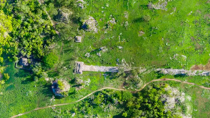
Archaeologists and anthropologists who studied Sacbe 1, or White Road 1, using the laser surveying method known as lidar (light detection and ranging) believe that the queen of the Maya city of Cobá, Lady K’awiil Ajaw, possibly ordered its construction around 680 A.D. so that her armies could travel along it in order to conquer Yaxuná – a Mayan city 100 kilometers to the west in modern day Yucatán state – as well as other smaller cities along the way.
Travis Stanton, an archaeologist at the University of California and lead author of a report published in the Journal of Archeological Science subtitled “An analysis of lidar data along the great road between Cobá and Yaxuná,” said that K’awiil Ajaw was one of the most powerful and hostile leaders of ancient Cobá. Carved stone monuments, or steles, depict her standing over hostages, he said.
“The bellicose nature of her monuments” suggested that she was the leader who built the road to Yaxuná, Stanton said.
According to Traci Ardren, an archaeologist, University of Miami professor of anthropology and second lead author of the report, the warrior queen may have ordered the road to be built in order to counter the growing influence of Chichén Itzá, a large Mayan city located about 23 kilometers north of Yaxuná that is one of the new seven wonders of the world.
“I personally think the rise of Chichén Itzá and its allies motivated the road,” she said.
“It was built just before 700, at the end of the Classic Period, when Cobá is making a big push to expand. It’s trying to hold on to its power, so with the rise of Chichén Itzá, it needed a stronghold in the center of the peninsula. The road is one of the last-gasp efforts of Cobá to maintain its power. And we believe it may have been one of the accomplishments of K’awiil Ajaw, who is documented as having conducted wars of territorial expansion,” Ardren said.

“The lidar really allowed us to understand the road in much greater detail. It helped us identify many new towns and cities along the road – new to us, but preexisting the road. We also now know the road is not straight, which suggests that it was built to incorporate these preexisting settlements, and that has interesting geopolitical implications. This road was not just connecting Cobá and Yaxuná; it connected thousands of people who lived in the intermediary region.”
Source: Live Science (en), Milenio (sp), The Engineer (en)