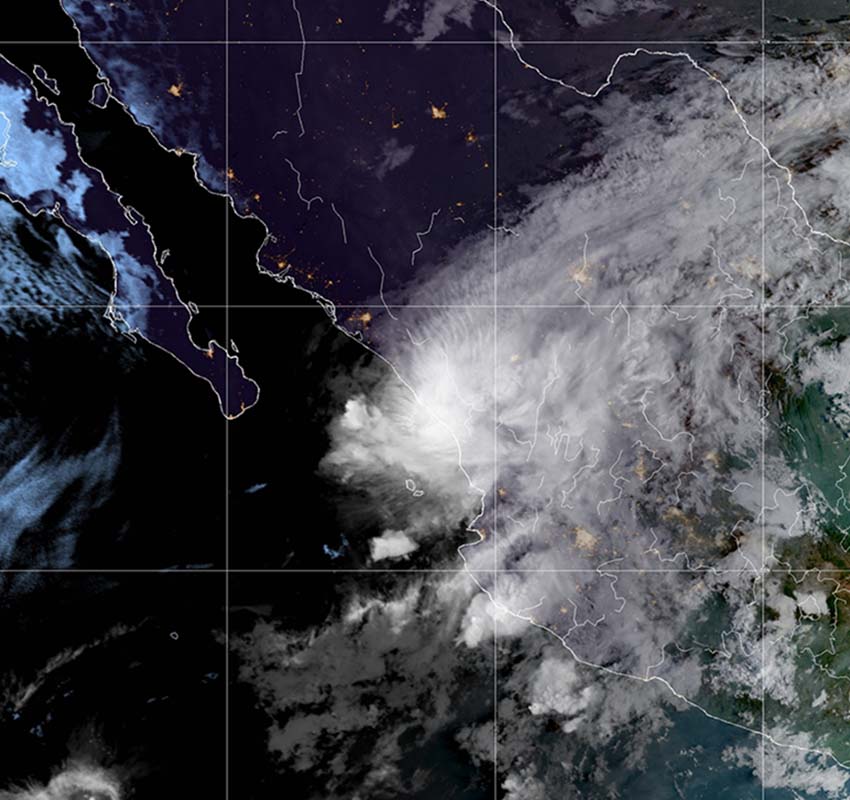
Hurricane Orlene made landfall in southwestern Mexico at around 8:45 a.m. Central Time, just north of the Sinaloa/Nayarit border, according to satellite imagery, the National Hurricane Center reported.
According to Mexico’s National Meteorological Service, the storm touched down 5 kilometers west-southwest of Isla del Bosque, located in the Sinaloa municipality of Escuinapa.
The NHC said that Orlene landed with maximum sustained winds of 140 kilometers per hour with higher gusts. At 9 a.m. Central Time, it was located 75 kilometers east of Mazatlán, the NHC said.
The hurricane, which strengthened into a Category 4 storm over the weekend before weakening, is moving north-northeast at 17 km/h, the NHC said. It is now a Category 1 storm, according to Mexico’s National Meteorological Service.
A hurricane warning is in effect for San Blas, Nayarit, to Mazatlán, Sinaloa.
“On the forecast track, the center of Orlene will reach the coast of mainland Mexico within the warning area this morning,” the NHC said.
“Rapid weakening is forecast after Orlene moves onshore, and the system should dissipate tonight or Tuesday, the NHC predicted. “Hurricane-force winds extend outward up to 15 miles (30 km) from the center and tropical-storm-force winds extend outward up to 90 miles (150 km),” it said.

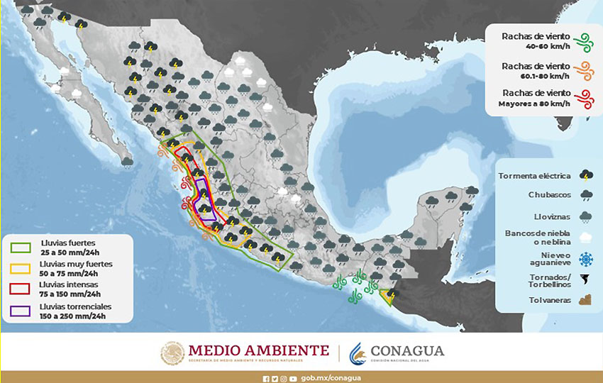
SMN said that Orlene would cause torrential rain in Sinaloa and Nayarit, intense falls in Durango and Jalisco and very heavy falls in Colima.
“These rainfall amounts are likely to lead to flash flooding, as well as possible landslides in areas of rugged terrain,” the NHC said.
The NHC predicted 3 to 6 inches (8-15 centimeters) for Nayarit and southern Sinaloa with “local amounts of 10 inches” or 25 cm. It forecast rainfall of up to 5 inches (13 cm) in Jalisco, Colima and southwest Durango. Conagua predicted as much as 25 centimeters (nearly 10 inches) could accumulate in some areas of Sinaloa and Nayarit.
States as far away as Michoacan, Guanajuato, Aguascalientes and Zacatecas could experience heavy rains as a result of Orlene, Conagua said.
“A dangerous storm surge is likely to cause coastal flooding in the Islas Marias and along the coast of mainland Mexico in the warning area in regions of onshore winds,” it also said.
The hurricane center also predicted large swells for the western coast of Mexico, southern parts of the Baja California peninsula and the Gulf of California “over the next day or so.”
“These swells are likely to cause life-threatening surf and rip current conditions,” the NHC said.
Mexico News Daily