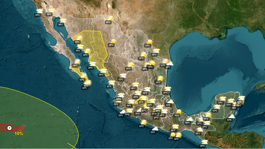
Low-pressure troughs and Tropical Wave 37 were baking large swaths of Mexico on Thursday, even as the Mexican monsoon was dumping heavy amounts of rain over much of the rest of the country.
The Pacific Coast states received the brunt of the storm system, although the Gulf-side municipality of Coatzacoalcos suffered extensive flooding after being pounded by an intense storm on Wednesday.
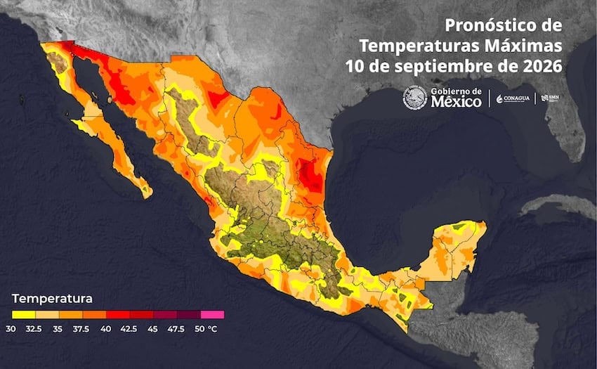
Cooler temperatures are expected on Friday, but for Thursday the National Meteorological Service (SMN) issued a heat alert for residents in north and northwestern Mexico. Temperatures above 45 C (113 F) were forecast for parts of Baja California and Sonora, with temperatures between 40-45 C (104-113 F) in parts of Sinaloa, Coahuila, Tamaulipas and Nuevo León.
“Stay hydrated, avoid prolonged exposure to the sun and take precautions against the heat,” the SMN advised in a social media post.
The heat wave extended south to Guanajuato and Guerrero, while some regions along the Gulf Coast saw temperatures hitting 38 C (100 F) on Wednesday.
At the same time, the rainfall map showed persistent heavy rains across the length and breadth of the country, accompanied by lightning and hail in some instances.
While Sinaloa was projected to get the most rainfall through Friday, the SMN said Guanajuato could expect to see the most intense midweek rains.

The SMN said rainfall produced by the Mexican monsoon could reach 150 millimeters in Sinaloa, Nayarit, Jalisco and Colima through Thursday. Very heavy and locally intense downpours were also forecast for Baja California Sur, Sonora and Sinaloa.
The Friday forecast also calls for continued heavy rain storms in central Sinaloa, with heavy to very heavy rainfall in Baja California Sur, Sonora, Durango and Nayarit.
The SMN said Tropical Wave 37 has been met by the arrival of Tropical Wave 38, which has crossed into the Yucatán Peninsula and southeastern Mexico from the east, increasing the likelihood of heavy rain in those regions through Sunday.
The SMN said the states of Campeche, Yucatán and Quintana Roo will register heavy to very heavy rainfall with electrical activity during the initial approach of the new weather system.
Veracruz, Tabasco, Chiapas, Oaxaca and Guerrero will also experience an increased probability of heavy rains with electrical discharges as the system moves west, while Michoacán, Jalisco, Colima and Nayarit will be affected by the passage of the phenomenon throughout the weekend.
With reports from El País, El Financiero, Milenio, Diario del Istmo and El Sol del Chilpancingo