The arrival of what could be the first named storm of the 2024 hurricane season has authorities along the coastline of the Gulf of Mexico on alert as meteorologists watch a potential tropical cyclone.
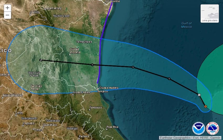
The U.S. National Hurricane Center (NHC) said as of 12 p.m. Mexico City time on Tuesday that there is a Tropical Storm Warning in effect for the northeastern coast of Mexico south of the mouth of the Rio Grande to Puerto de Altamira, as well as parts of the Texas coast. Mexico’s National Meteorological Service (SMN) says the potential tropical cyclone, to be named “Alberto” could make landfall in northeastern Mexico on Wednesday night or Thursday morning.
🌪️🌊¡Tromba marina a la vista!
En redes sociales circula un video sobre una tromba marina reciente o #tornado de agua frente a la playa de #Tulum, #QuintanaRoo debido a la nubosidad densa en la región y los fuertes #vientos. Hasta el momento no se registran daños.
📽️:… pic.twitter.com/pJXZKjsN6w— SkyAlert Storm (@SkyAlertStorm) June 17, 2024
This water spout was seen from beaches in Tulum on Monday, as cloudy and rainy conditions continue in the area.
As of 10 a.m. Tuesday, the storm was located in the Bay of Campeche in the southwestern corner of the Gulf of Mexico. The National Hurricane Center said in their 12 p.m. advisory on Tuesday, “a turn toward the northwest and west with an increase in forward speed is expected tonight and on Wednesday, and the system is forecast to reach the Gulf coast of Mexico by Wednesday night.”

While the cyclone is projected to make landfall in southern Tamaulipas, it is also forecast to drench the states of Puebla, Campeche, Tabasco, Quintana Roo and Yucatán.
The state of Quintana Roo has already seen torrential rains since Sunday, causing flooding in the cities of Chetumal and Cancún, where authorities reported an accumulation of 115 mm of rainfall overnight on Monday.
The SMN also warned of heavy rains in the interior of the country when the cyclone is forecast to push ashore on Thursday.
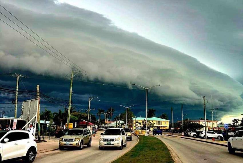
In addition to actions undertaken by the federal government — issuing alerts, closing ports and setting up response teams — state and municipal governments are also taking precautionary measures. Authorities will jointly monitor rivers, dams and reservoirs in the affected areas. The National Water Commission (Conagua) reported that reservoirs in Tamaulipas are only 20% full, so there is adequate space to capture the rainwater and reduce the impact of flooding.
The Yucatán state government issued a Blue Alert for high winds and high waves while in Veracruz the government issued a Gray Alert for heavy rains and high winds as a result of the cyclone.
The Nuevo León state government declared a maximum alert and civil protection authorities decided to close schools starting Wednesday, and continuing through Thursday and Friday as a precaution, according to a Tuesday morning post on X by Governor Samuel García.
With reports from La Jornada, La Jornada Maya and El Universal