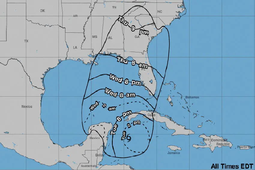
A tropical storm warning is in effect for the Yucatán Peninsula as Tropical Storm Helene barrels toward Mexico’s southeastern coast.
The warning zone goes from Río Lagartos, Yucatán, to Tulum, Quintana Roo. A hurricane surveillance zone is in effect from Cabo Catoche to Tulum, both located in Quintana Roo.
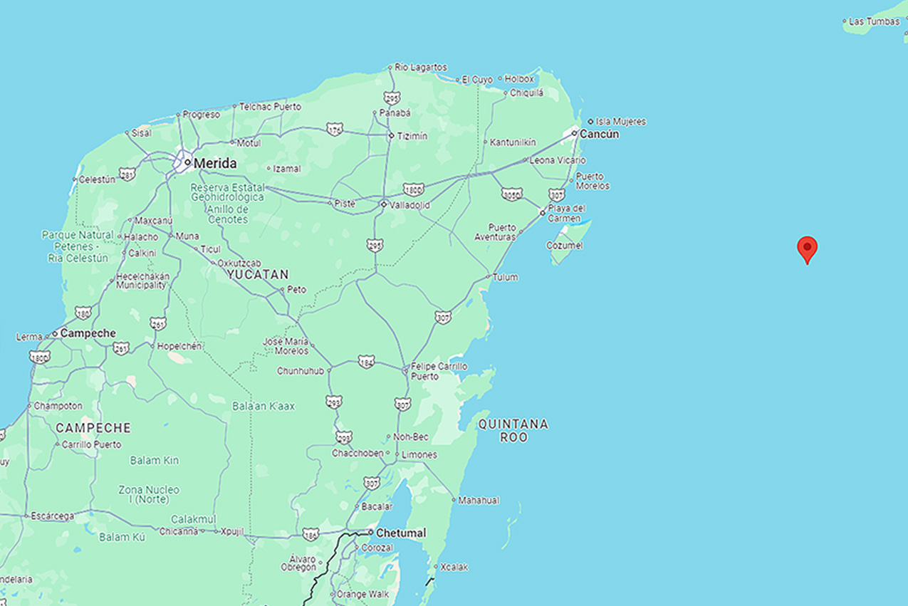
Helene formed in the northwestern Caribbean Sea Tuesday morning. According to the National Meteorological Service (SMN), Helene was located 280 kilometers east-southeast of Cozumel and 310 kilometers southeast of Cancún as of noon, with sustained winds of 75 km/h (47 mph) and gusts as high as 90 km/h (about 56 mph).
According to the United States National Hurricane Center (NHC), at about the same time, Helene was traveling toward Mexico at a speed of about 19 km/h (12 mph).
The NHC predicts Helene could reach near-hurricane strength in the Caribbean Sea at times but will remain a tropical storm. It will likely strengthen into a Category 3 hurricane once it leaves Mexico as it moves toward the United States’ southeastern coast.
The storm’s current path puts it on track to make landfall as a hurricane on Thursday in Florida.
“Helene is expected to rapidly intensify over the eastern Gulf of Mexico and be a major hurricane when it approaches the northeastern Gulf Coast on Thursday,” a statement by the NHC on Tuesday said.

Llega el primer barco de evacuación gratuita y voluntaria de la isla de Holbox. pic.twitter.com/tHjfMxzDpC
— Mara Lezama (@MaraLezama) September 24, 2024
The state of Quintana Roo was providing free evacuation service by ferry to residents of Holbox Island Tuesday, in preparation for Helene’s passage.
The rain and wind forecast by state in Mexico’s Yucatán Peninsula for Tuesday is as follows:
Quintana Roo and Yucatán: Torrential rainfall (150 to 250 mm) with wind gusts of 100 to 120 km/h and waves from 3 to 5 meters high in coastal areas.
Campeche: Very heavy rainfall (150–250 mm) with gusts of wind from 50 to 70 km/h and waves from 1 to 3 meters high in coastal areas.
Intense rainfall could lead to landslides, increased river and stream levels, and flooding in low-lying areas. Due to the rainy, windy, and high wave conditions, the SMN urged residents to attend to its warnings and follow the recommendations of state Civil Protection officials.
On Tuesday, Quintana Roo Gov. Mara Lezama offered a free ferry service for tourists to leave the coastal island of Holbox, north of the state. Quintana Roo municipalities Lázaro Cardenas, Benito Juarez, Isla Mujeres, and Cozumel were also offering free evacuation shelters in public buildings on Tuesday, including pet-friendly shelters.
Quintana Roo is home to the popular beach resorts of Cancún, Playa del Carmen, Isla Mujeres and Tulum.
Hurricane John makes landfall
Meanwhile, Hurricane John made landfall as a Category 3 storm in Punta Maldonado, Guerrero — bordering the state of Oaxaca — on Monday night.
Due to John, the SMN forecast more than more than 250 mm of rain in Guerrero and Oaxaca, torrential rainfall in Chiapas (150–250 mm) and 75–150 mm for Michoacán, Puebla, Tabasco, and Veracruz for Tuesday.
These weather conditions will further increase the likelihood of heavy showers in the central part of the country, including the Valley of Mexico.
With reports from La Jornada Maya