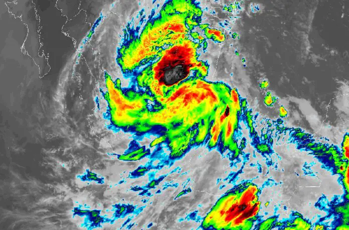
Tropical Storm Alberto, the first named storm of what is expected to be a busy Atlantic hurricane season, made landfall in the state of Tamaulipas and quickly weakened into a tropical depression Thursday morning.
The U.S. National Hurricane Center (NHC) noted that heavy rains and flash flooding were expected to continue as Alberto moved west at 30 km/h. Storm warnings and coastal watches were discontinued, however, even though wind and rain extend far from the storm’s center.
#Entérate | En Ramos Arizpe, #Coahuila pasajeros que viajaban en un autobús tuvieron que ser rescatados al quedarse en medio de una inundación. La tormenta tropical #Alberto los dejó atrapados en el Parque Industrial Santa María. pic.twitter.com/pSyUNSo6C4
— Oscar Lozano (@oscarlozanomx) June 20, 2024
Stranded passengers being rescued from a bus in Ramos Arizpe, Coahuila, Thursday morning after flash flooding caused by Tropical Storm Alberto filled the Santa María Industrial Park.
On Thursday morning, the most intense rains were occurring in the states of Tamaulipas, Coahuila, Nuevo León and San Luis Potosí, according to Mexico’s National Meteorological Service (SMN). Rain totals of 13 to 25 centimeters were expected at higher elevations, which could lead to reduced visibility, landslides, flooding and rising rivers and streams.
Very heavy rains (75 to 150 millimeters) are expected in Durango, Zacatecas, Guanajuato, Querétaro, Hidalgo, Puebla, Veracruz, Oaxaca and Chiapas.
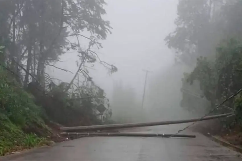
In Chiapas, four portions of roadway were rendered impassable Thursday due to landslides and flooding, with emergency services unable to immediately reach the affected areas due to heavy rains. In Veracruz, a landslide dropped huge boulders onto one stretch of roadway, and a sinkhole developed in the capital city of Xalapa.
Many other states across Mexico will experience some amount of Alberto-related rain on Thursday, ranging from heavy rains to occasional showers.
Alberto was named a tropical storm on Wednesday, leading to the suspension of classes in several regions and the implementation of other safety preparations.
🚨 #RíoSantaCatarina, #NuevoLeón, al momento. Recuerda ☝️⛑ evita cruzar vados, arroyos y ríos.
No expongas tu vida.Vía: @PC_NuevoLeon.pic.twitter.com/A6Sdkgs5sh
— Webcams de México (@webcamsdemexico) June 20, 2024
Footage of the Santa Catarina river in Monterrey, Nuevo León, around 1 p.m. Thursday, being lashed by heavy rains from Alberto. (Webcams de México)
But it weakened rapidly after making landfall early Thursday morning. By 9 a.m., it was downgraded to a tropical depression when it was located 155 kilometers west of Tampico, Tamaulipas.
Maximum sustained winds were 75 km/h when Alberto made landfall, but then they slowed to 55 km/h.
Initially, there was some chagrin in Tampico that the amount of rainfall was low and wouldn’t put much of a dent in Mexico’s ongoing drought, reported the Associated Press (AP).
“We had hoped that it would come because water is so needed here, but at far as I can tell, it went somewhere else,” Tampico resident Marta Alicia Hernández told AP.
However, the outer bands of the system will likely bring the heavier rains that other areas experienced Thursday morning.
In Nuevo León, civil protection authorities have linked three deaths to Alberto’s heavy rains. A 16-year-old in Monterrey died in a river, trapped by the currents when he attempted to retrieve a soccer ball, and two 12-year-olds in the state were electrocuted in the municipality of Allende when they rode their bikes through a large puddle that was in contact with a live wire.
Nuevo León Governor Samuel García wrote on the social media platform X that metro and public transportation services would be suspended in Monterrey from Wednesday night until midday Thursday.
In Tamaulipas and Veracruz, officials closed all schools on Thursday (and some on Friday), and shelters were prepared in case residents would need to flee high waters.
Areas at higher elevations could see as much as 50 cm of rain, which could result in mudslides and flash flooding, especially Tamaulipas, Coahuila and Nuevo León.
Raúl Quiroga Álvarez, the Tamaulipas state minister of hydrological resources, said at a press conference Wednesday night that because the wind speeds were not “a risk,” his drought-ravaged state was actually looking forward to all the rain.
“This is what we’ve been waiting for for eight years in all of Tamaulipas,” he said. “This is a win-win event.”

In his Thursday morning press conference, President Andrés Manuel López Obrador said that members of the armed forces had been deployed in the storm areas to address possible damage.
Forecasters have predicted that the 2024 Atlantic hurricane season could be much more active than usual, with 17 to 25 predicted named storms this year. On average, there are 14 named storms per season.
The U.S. Hurricane Center currently is monitoring a broad area of low pressure that’s forming in the southwestern Gulf of Mexico.
As it moves over southeastern Mexico on Friday and over the Bay of Campeche on Saturday, it could develop into a tropical depression that will likely move slowly to the north and west.
With reports from El Universal, Milenio, Associated Press and New York Times
