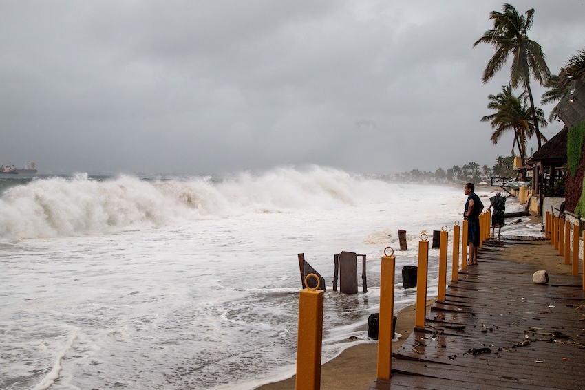
Hurricane Priscilla strengthened early Monday as it moved parallel to Mexico’s Pacific coast, prompting authorities to issue storm warnings.
Priscilla — which is expected to become a Category 2 hurricane in the coming days — is bringing rain to much of mainland Mexico and gusty winds along the western coast, prompting the National Meteorological Service (SMN) to issue a Tropical Storm Watch in five states.
The Watch was issued for the mainland from Punta San Telmo, Michoacán, north to Punta Mita, Nayarit, and from Cabo San Lucas to Colonia Santa Fe in Baja California.
The threat was such that Colima state officials ordered the evacuation of all beachfront areas on Sunday while also shuttering the port of Manzanillo, the country’s most important maritime port.
The Category 1 hurricane, which was tracking slowly north-northwestward at 7 kilometers per hour, was located 350 km south-southwest of Cabo Corrientes, Jalisco (near the resort town of Puerto Vallarta), and 655 km south-southeast of Cabo San Lucas, Baja California Sur at 9 a.m.
The U.S. National Hurricane Center (NHC) said Priscilla’s center “is expected to move offshore of and parallel to the coast of southwestern Mexico and Baja California Sur through the early-to-middle part of this week.”
In an 8 a.m. experimental cone forecast, the NHC reported that sustained winds of 85 mph (140 kph) — with gusts reaching 105 mph (170 kph) — were expected to cause dangerous surf and rip currents along coastal southwestern and west-central Mexico, as well as southern Baja California.

The National Water Commission (Conagua) posted a warning on social media, urging extreme caution in coastal areas. Conagua said waves of up to 6 meters could reach the beaches of Jalisco and Colima, with breakers of up to 4 meters coming ashore in Michoacán and 3-meter-high waves in the states of Nayarit and Guerrero.
The NHC warned that hurricane-force winds extended outward up to 50 miles (85 km) from the center and tropical-storm-force winds extended outward up to 205 miles (335 km).
Conagua forecast torrential rains (150 to 250 millimeters) in Michoacán, and intense rains (75 to 150 mm) in Jalisco, Colima and Guerrero on Monday.
As the storm has the potential to reach major hurricane status (Category 3 and above), Conagua and the SMN urge the public to pay heed to state and local authorities as they monitor Priscilla’s progress.
With reports from La Jornada, CBS News, the New York Times and El Financiero