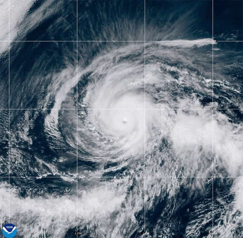
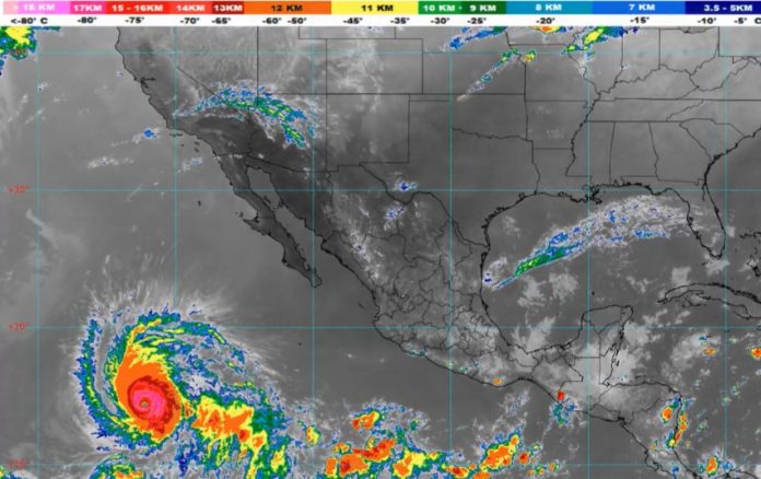
Hurricane Kristy reached the highest level of the Saffir-Simpson Hurricane Wind Scale as a very powerful Category 5 hurricane Thursday afternoon. However, it quickly weakened on Thursday evening over the open Pacific Ocean, southeast of Mexico’s Baja California Peninsula.
According to the National Hurricane Center in the U.S., it weakened to a Category 3 this Friday morning.
Esta mañana, en aguas del #Pacífico, #Kristy se debilitó a #Huracán de categoría 3 en la escala #SaffirSimpson. Se localiza a más de mil kilómetros del territorio nacional. Detalles, en la imagen pic.twitter.com/9h8pWSBdRX
— CONAGUA Clima (@conagua_clima) October 25, 2024
According to the National Water Commission (Conagua), the hurricane poses no risk to Mexico due to its location and trajectory. Nevertheless, large swells are expected on the west coast of the Baja California Peninsula today and for the rest of the weekend.
“These swells are likely to cause life-threatening surf and rip current conditions,” the United States National Hurricane Center warned.
Kristy formed from the remnants of former Nadine, an Atlantic tropical storm that re-formed after hitting Belize and moving across Central America into the Pacific over the weekend. It is expected to weaken again into a tropical storm and dissipate early next week.
Predictions for the 2024 hurricane season in Mexico
The tropical cyclone season began on May 15 in the Northeast Pacific Ocean and June 1 in the Atlantic Ocean, including the Caribbean and Gulf of Mexico. Both regions will remain under constant surveillance until Nov. 30, when the season officially ends.

However, experts warn that cyclones can form even outside of these dates, which keeps authorities on alert until December.
The forecast for the 2024 hurricane season predicted above-average activity in the Atlantic, with average intensities potentially up to 50% higher than in previous years, as a consequence of the climate crisis. This season, a total of 35 to 41 cyclones are expected, including tropical depressions, tropical storms and hurricanes.
Fifteen to 18 cyclones were forecast for the Pacific Ocean, while the Atlantic forecast predicted 20 to 23 cyclones. As of October 16, the Pacific has recorded 10 cyclonic events while the Atlantic has seen 13. More tropical storms are expected for the coming weeks before the season ends.
The weather forecast for this weekend
On Friday, a large trough over the western Gulf of Mexico and the southeastern region of the country, along with a high-altitude trough and incoming humidity, will bring rain to the northeast, east, and southeast areas of Mexico, including the Yucatan Peninsula.
The rain forecast is as follows:
- Very heavy rainfall (50 to 75 millimeters): Tabasco, Chiapas, Campeche and Quintana Roo
- Heavy rainfall (25 to 10 millimeters): Guerrero, Oaxaca, Puebla, Veracruz and Yucatán
- Moderate rainfall (5 to 25 millimeters): Tamaulipas, San Luis Potosí, Jalisco, Colima, Michoacán, Hidalgo, Querétaro and Mexico state
- Light rainfall (less 5 to 25 millimeters): Nuevo León, Durango, Sinaloa, Nayarit and Guanajuato.
