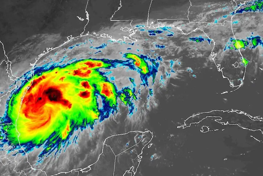
Tropical Storm Francine in the Gulf of Mexico brought extreme weather to Mexico’s northeastern coast on Monday, and is expected to become a Category 1 hurricane by the time it hits the north-central Gulf Coast of the United States on Wednesday.
As of 12 p.m. Mexico City time on Monday, Francine had maximum sustained winds of 95 km/hour and was located about 200 kilometers off the coast of Tamaulipas according to the U.S. National Hurricane Center (NHC).
#PTC6 will soon be named as Tropical Storm #Francine.
The system is expected to steadily strengthen into a hurricane before making landfall over Louisiana on Wednesday 🌀
Latest GFS wind forecast: pic.twitter.com/0KGK4VnU7G
— Zoom Earth (@zoom_earth) September 9, 2024

After nearly a month without a storm in the Atlantic Ocean — the longest streak since the 1960s — Tropical Storm Francine formed over the Gulf of Mexico on Monday and is taking aim at the Texas-Louisiana border.
Early Monday, the NHC still classified the system as Potential Tropical Cyclone No. 6, a designation that allows the NHC to issue tropical storm watches and warnings before the system becomes an officially named storm.
That changed quickly, however. As it strengthened into a named tropical storm, Francine began affecting Mexico’s Gulf coast. Mexico’s National Meteorological Service (SMN) issued a statement reporting “extraordinary storms” in Tamaulipas, “torrential rains” in Veracruz and “intense storms” in several other states.
Prior to that, the SMN issued its daily weather forecast still referring to Tropical Cyclone No. 6, explaining that the storm in the western part of the Gulf was being fed by weather front No. 1 (a cold front) and Tropical Wave No. 21, the latter of which had traversed southern Mexico, dumping considerable rain on Chiapas and Oaxaca.
Interacting with humid air from the Caribbean, the storm was poised to drench the Gulf coast and make it a rainy day across Mexico, according to the national weather agency.
The SMN warned Gulf Coast residents that high winds associated with the mass of cold air could potentially lead to storm damage in Tamaulipas, Veracruz and Tabasco.
The NHC also warned that Francine was generating surf swells along Mexico’s Gulf coastline , forecasting that they would spread north-westward across the coast through midweek. The swells pose life-threatening surf and rip current conditions, the NHC added, and minor coastal flooding in Tamaulipas is expected.
Tropical storm conditions could impact the northern coast of Mexico and extreme southern Texas beginning Tuesday, with total rainfall forecast between 101 mm and 203 mm, as well as along portions of the Texas and Louisiana coasts on Wednesday.
The NHC forecast shows Francine intensifying into a Category 1 hurricane before landfall, which is expected by Wednesday evening.
Two other areas in the open Atlantic have a moderate chance of developing into storms in the next seven days, according to the NHC.
With reports from CNN and El Financiero