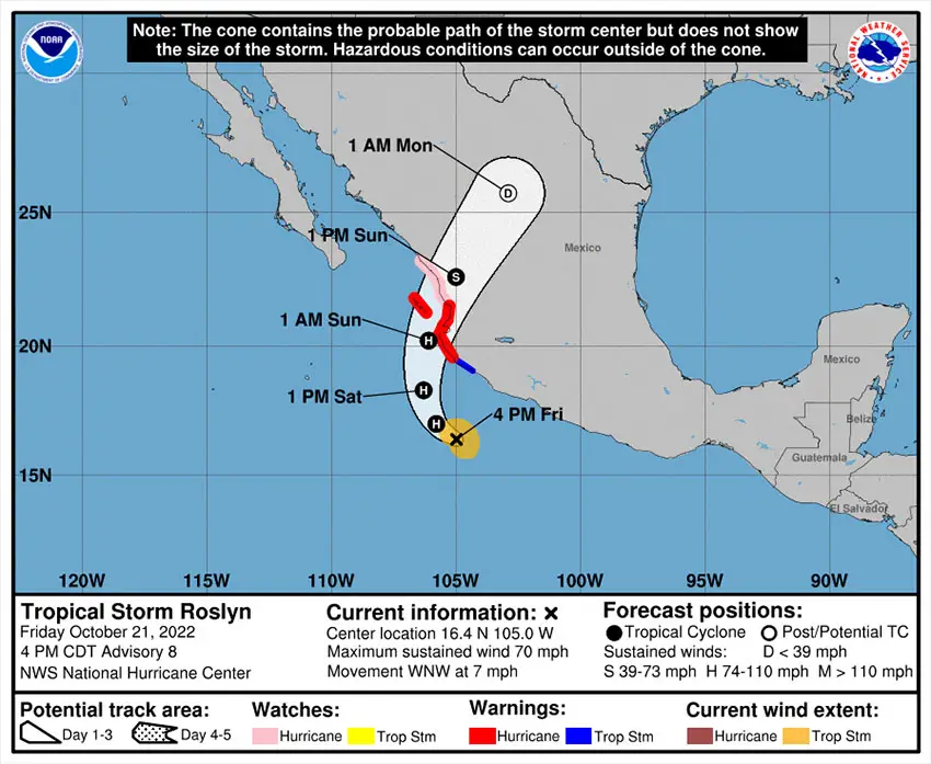
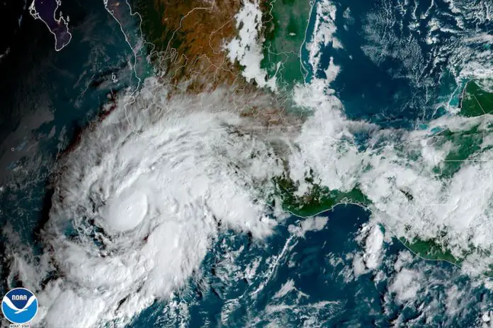
Tropical storm Roslyn – forecast to become a hurricane Friday night – is on track to make landfall in Jalisco or Nayarit Saturday night or Sunday.
Roslyn was just below hurricane strength at 4 p.m Central Time and located 300 kilometers south-southwest of Manzanillo, Colima, the United States National Hurricane Center (NHC) said in an advisory.
A hurricane warning is in effect between Playa Perula, Jalisco, and San Blas, Nayarit, an area that includes Puerto Vallarta, Jalisco. The warning also affects the Islas Marías, an archipelago of four islands off the coast of Nayarit. A hurricane watch is in effect for the area north of San Blas to Mazatlán, Sinaloa.
The NHC said that Roslyn had maximum sustained winds of 110 kilometers per hour with higher gusts at 4 p.m., and that the storm was moving west-northwest at 11 km/h.

“A turn toward the northwest and north-northwest is forecast tonight, followed by a northward and then north-northeastward motion Saturday and Saturday night. On the forecast track, the center of Roslyn will move parallel to the southwestern coast of Mexico today and tonight, then approach the coast of west-central Mexico, making landfall along this coastline Saturday night or Sunday,” it said.
The NHC said that “steady to rapid strengthening” is forecast “during the next day or so,” adding that the storm is expected to become a hurricane Friday night. A category 1 hurricane has sustained winds of 119-153 km/h, meaning that Roslyn was only nine kilometers short of hurricane status at 4 p.m.
The NHC said that Roslyn is expected to still be a hurricane when it makes landfall and noted that tropical storm strength winds could be experienced on land by midday Saturday, “making outside preparations difficult or dangerous.”
“Preparations to protect life and property should be rushed to completion,” the Florida-based authority said.
The NCH said that the northern coast of Colima, Jalisco, Nayarit and southeastern Sinaloa are expected to receive 4-6 inches (10-15 cm) of rain with maximum falls of 8 inches (20 cm).
“This rainfall could lead to flash flooding and landslides in areas of rugged terrain,” it said, adding that “a dangerous storm surge is expected to produce significant coastal flooding near and to the east of where the center [of Roslyn] makes landfall.”
The hurricane center also warned of “large and destructive waves” accompanying the surge.
“Swells generated by Roslyn are affecting portions of the coast of southwestern Mexico and will spread northward to the coast of west-central Mexico and the southern portion of the Baja California peninsula through the weekend,” the NHC said. “These swells are likely to cause life-threatening surf and rip current conditions.”
Roslyn is the 18th named storm of the 2022 Pacific hurricane season, excluding Hurricane Bonnie, which crossed into the Pacific from the Atlantic Ocean. Hurricane Agatha, the first named storm of the Pacific season, claimed lives and caused significant damage after it made landfall in Oaxaca on May 30.
Mexico News Daily
