

All five of Mexico’s major ecosystems converge in the state of Jalisco. In this article, we’ll provide a guide to the semi-arid scrubland that characterizes the northeast section of the state, popularly known as Los Altos de Jalisco, or the Highlands.
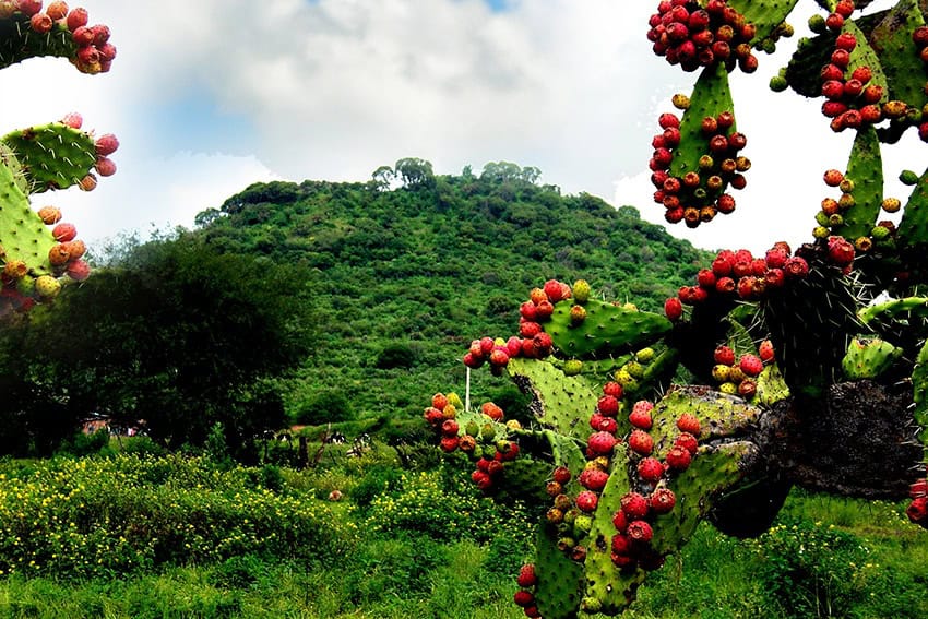
This area has few hills but plenty of flat, grassy plains covered with countless huisaches (acacia trees) and nopales (cactuses). The typical elevation is around 2,000 meters. The terrain favors ranching, and Los Altos depends mainly on raising cattle, closely followed by pigs and chickens.
The Upside-Down Wicker Basket
To get a feel for the high flatland environment, visit the ruins of the little-known Pyramid of Pegueros, also called Chiquihuitillo, the Upside-Down Wicker Basket, located 60 kilometers northeast of Guadalajara.
The pyramid is curious because, according to archaeologist Phil Weigand, the pre-Columbian inhabitants of this flat area decided to first build themselves a hill and then construct a pyramid on top of it. To create that hill, Weigand calculated they had to move 66,000 cubic tons of earth.
The main reason I’m sending you to this pyramid is that the spot is only reachable on foot — a short walk of 600 meters — obliging you to hike through the typical scrubland of Los Altos. Here you may come across acacia trees, thistles and maybe even a few Jimson-weed flowers, said to be used as a love potion, but infamous as a drug producing temporary insanity. Could there possibly be a connection?
Hot springs and magnificent views
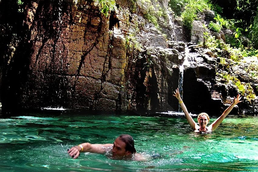
When you’ve seen enough thorns and scrub, you can opt for an entirely different environment by heading for the 150-kilometer-long Río Verde Canyon, which runs north and south through the highlands. Here you’ll find majestic waterfalls and, at the bottom, a semi-tropical environment dotted with numerous hot springs.
One of my favorite places in the canyon is Rancho El Venado, which offers bungalows, campsites and a delightful natural hot shower — all of them featuring magnificent views of towering, red canyon walls, 400 meters high.
After a refreshing night at Rancho El Venado, you might want to venture further north in Los Altos to the little-known archaeological ruins of Teocaltitán, 100 kilometers northeast of Guadalajara. Here you’ll find one of those rarities in the flatlands: a natural hill. What better place for pre-Columbian people to construct a ceremonial center?
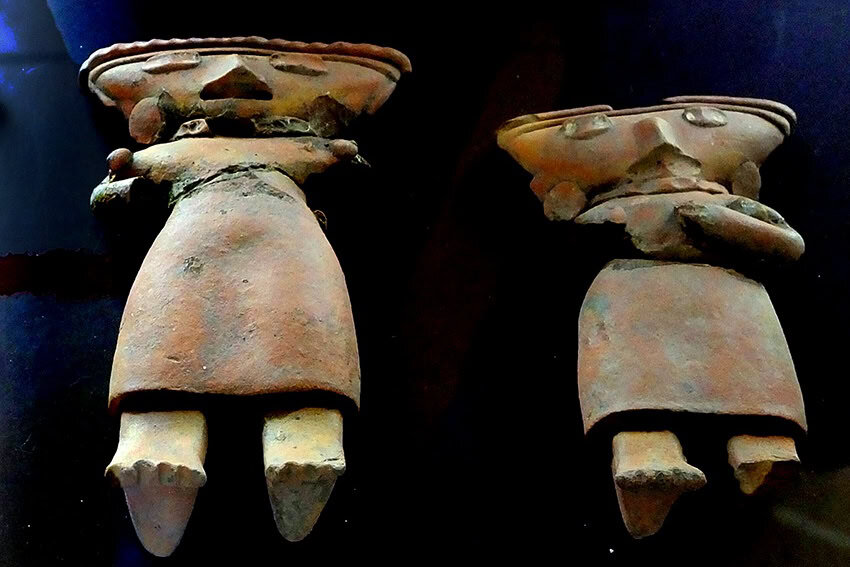
Ruins of the Cookie People
Between A.D. 400–900, this part of Mexico was controlled by a civilization whose name no one knows. Some call them the Cookie People because the figurines they made were flat and shaped like gingerbread men.
To confuse things even more, archaeologists call them the El Grillo (Cricket) People, after a spot in Guadalajara where their particular architecture was first noticed.
The rectangular “sunken patio” was one of the essential features of their ceremonial centers, and Teocaltitán has one of the best examples of one: a huge flat area where thousands of people gathered, perhaps to dance or to follow a ball game being played not far below the patio.
Apart from these impressive structures, now under restoration, Teocaltitán offers visitors who make it to the top a magnificent view — perhaps the best view you can possibly get — of the mostly flat highlands.
Another little-known archaeological treasure in Los Altos is a lagoon called Presa de la Luz, located 120 kilometers east of Guadalajara near the town of Arandas.
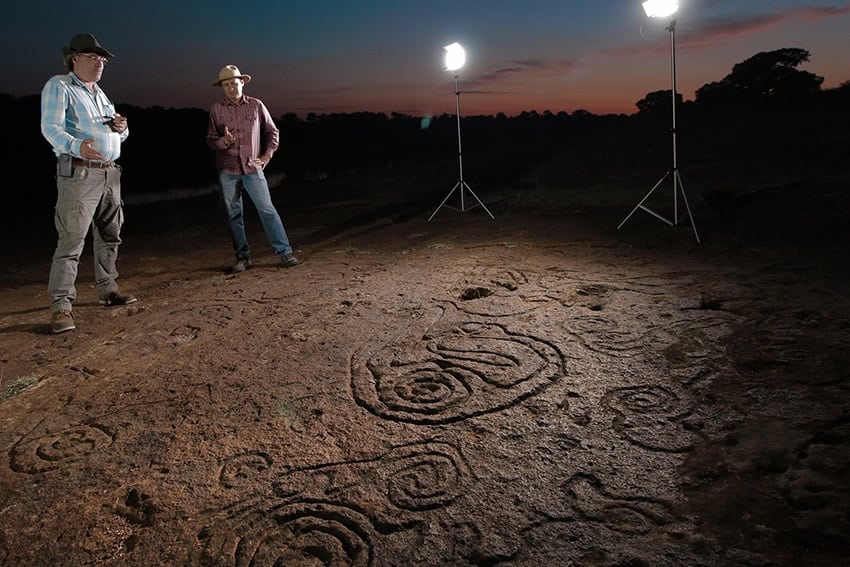
Calendars engraved in rock
In 2006, a local rancher used a tractor to clear a spot on the shore of the Presa de la Luz. Scraping off a thin layer of topsoil, he discovered a great many petroglyphs, some very elaborate. Investigation of the lakeshore revealed a total of 1,200 rock engravings.
Fourteen of these are pecked crosses, which typically consist of 260 small holes or cups, forming a cross inside a circle. As this is the number of days in the Mesoamerican year, a pebble placed in the cups may have served as a practical calendar.
Visits to Presa de la Luz are not allowed due to the softness of the rock, but you can appreciate this unique site via a well-illustrated book entitled “El Santuario Rupestre de Los Altos de Jalisco” by Rodrigo Esparza and Francisco Manuel Rodríguez Mota.
La Presa de la Luz may be unique for the sheer number of engravings on its shore. Curiously, only 15 kilometers north of this lagoon, there is another unique archaeological site, which I call the 1,800 Bowls of the Río Raso.
Chiseling a bowl-shaped hole on the surface of a rock has a purpose similar to chiseling a spiral: Both were considered the equivalents of simple prayers for rain.
In the case of the Río Raso, however, someone got carried away 1,000 years ago, covering a 400-meter-long stretch of the river’s rocky bed with nearly 2,000 “prayers,” nicely lined up in rows.
Carne asada, Los Altos style
After wandering about the highlands, you’ll surely work up an appetite. Here’s a chance to try one of Los Altos’ specialties: carne asada.
I am told that the very best place to get it is at a restaurant called Carnitas El Alteño in the town of Jalostotitlán. Here, you will also find numerous brands of locally made tequila with a unique highland flavor.
John Pint has lived near Guadalajara, Jalisco, for more than 30 years and is the author of “A Guide to West Mexico’s Guachimontones and Surrounding Area” and co-author of “Outdoors in Western Mexico.” More of his writing can be found on his website.