

Over the past months—with the collaboration of outdoor enthusiasts living in different parts of Mexico—I’ve listed some excellent hikes you can do from San Miguel de Allende, Monterrey, and Queretaro, not to mention several really spectacular ones you can do inside Mexico City, without ever leaving town. This time around, I want to describe some delightful places you can visit from the city of Guadalajara.
This is an easy task because Guadalajara is literally surrounded by captivating canyons, waterfalls, forests, hot springs, jungles, volcanoes, and much more. I’ve described 90 such sites in a series of books called Outdoors in Western Mexico plus another 10 great places you will find in my Guide to West Mexico’s Guachimontones and Surrounding Area.
Why are there so many attractive outdoor sites within easy reach of Guadalajara?
Guadalajara happens to lie at a spot where all five of Mexico’s ecosystems come together. So, whichever direction you leave the city, you’ll soon find yourself in a different environment with its own flora, fauna, and geology. It’s so extraordinary that I decided to call the area within a day’s drive of Guadalajara, “The Magic Circle.”
Here are a few examples of great places you can easily visit from Mexico’s second-largest city.
Río Caliente
This hot river is the number one attraction of the vast Primavera Forest which lies directly west of Guadalajara. Studies show that the water is chock full of minerals, including organic lithium, and for years people from all over the world flocked to the Río Caliente Spa (now closed) to soak in its healing waters.
Today most people come here to take a dip in the rustic pools, constructed at a point where the river is really hot, right next to a large parking lot easily reachable by any sort of vehicle. This place is always open!
From this parking area, hikers may choose to follow a trail paralleling the river, eventually leading to the cooled-down section of Río Caliente known as Rio Salado (Salty River) where bathers can enjoy a soothing Jacuzzi effect caused by water swirling around rocks. Search Google Maps for “MCMF+34 La Primavera, Jalisco” to reach the Río Caliente parking area. It’s a 35-minute drive from the west end of Guadalajara.

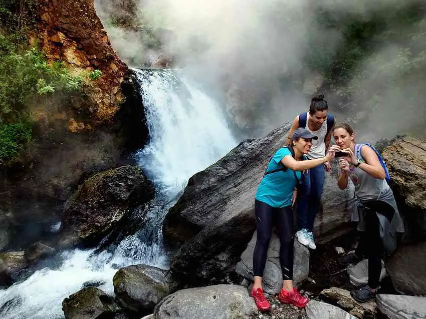
La Barranca de Huentitán
This hike takes you 500 meters down to the bottom of the spectacular canyon which forms the northern boundary of Guadalajara. The view is breathtaking and so is the steep, zigzagging trail. Once you’ve reached the Santiago River at the bottom, a short walk downstream will bring you to the picturesque Arcediano Suspension Bridge, the historic gateway to all points north of Guadalajara in bygone days. Would you believe that the record for running down and back up this steep path is 43 minutes?
To reach the trailhead, ask Google Maps to take you to “Barranca de Huentitán-Capilla y Camino Empedrado.”
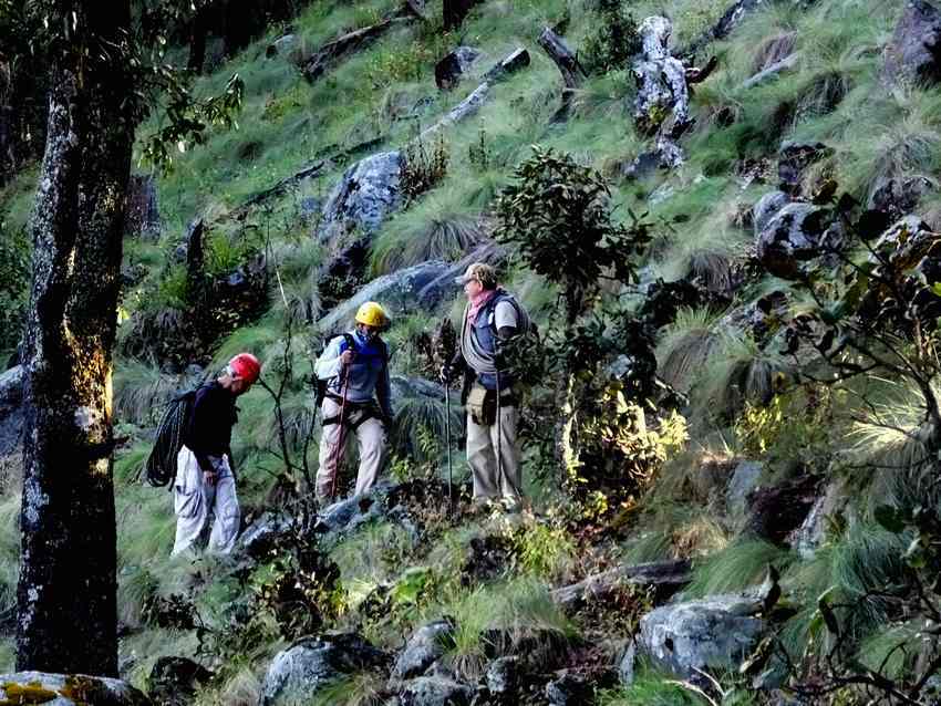
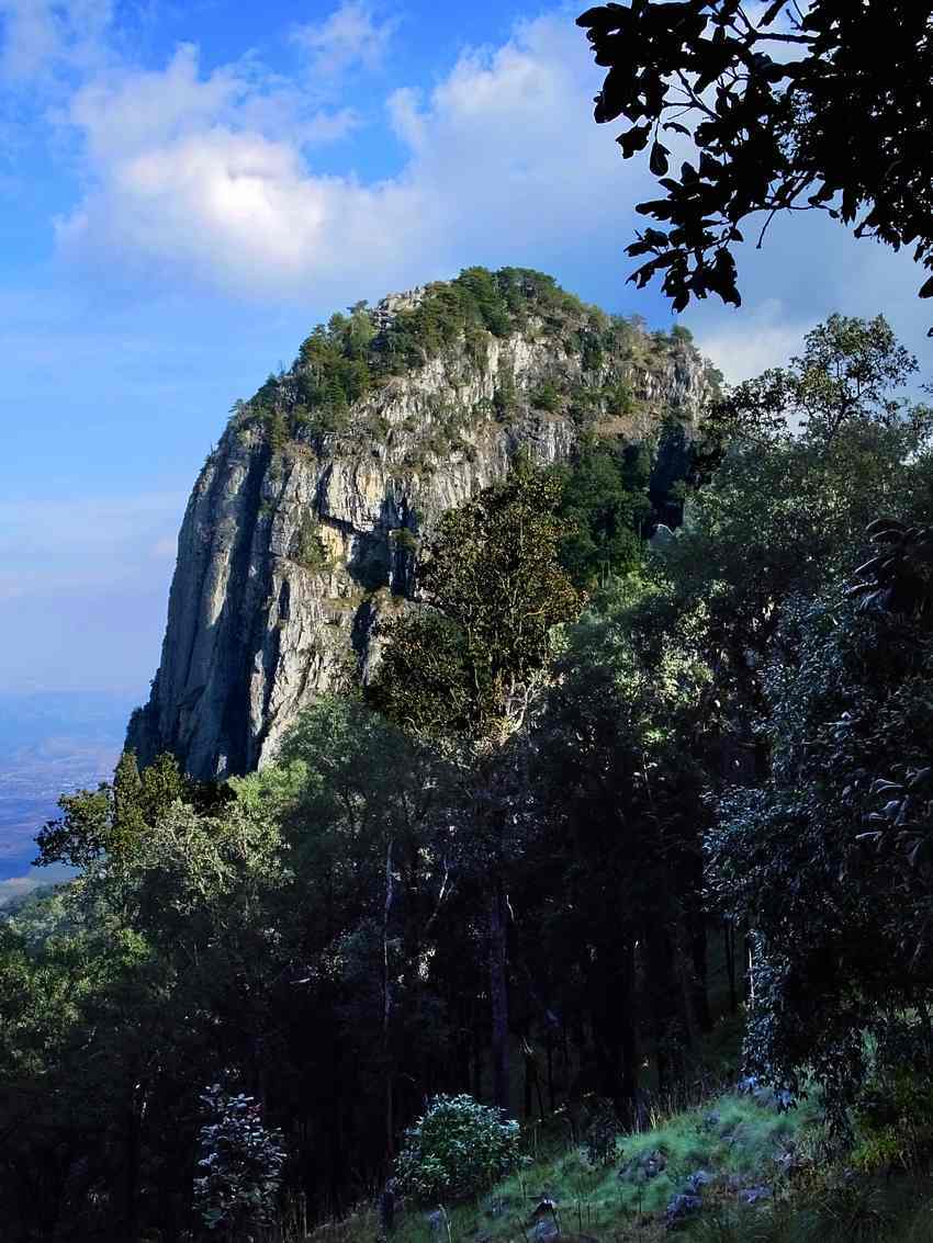
El Diente

Here is a beautiful location six kilometers north of town, filled with huge rocks 30 million years old, including a few that look like giant teeth. It’s the favorite hangout of Guadalajara’s rock-climbing community. On any weekend you can spend hours watching them inch their way up impossible-looking surfaces set at crazy angles. If you wish, you can do a most interesting six-kilometer loop hike around the monolith-topped peak. Look for “El Diente Zapopan, Jalisco” to get you to this unique site.
Rio Seco
The north-central part of the Primavera Forest is characterized by slot canyons typically varying in width from two to ten meters, with sheer walls rising as high as 50 meters. From your access point near the town of La Venta del Astillero (ten kilometers west of Guadalajara), you can follow the Rio Seco for 3 kilometers, frequently walking among huge boulders of pumice, a rock so light it actually floats. Erosion is forever sculpting these soft volcanic walls, creating bizarre shapes and scenes that look different every time you visit the place.
To reach the trailhead, ask Google Maps for “PFC6+78J La Venta del Astillero, Jalisco.” The hike begins near the lip of a high cliff at the south end of La Venta del Astillero. Park far from the cliff edge and follow an old cobblestone road that takes you south, down into the canyon. From here the Rio Seco takes you east for two kilometers and then goes south for another three kilometers. When you’re tired of walking, head back the way you came. Shortcuts are not recommended in an area crisscrossed by slot canyons!
Tequila Volcano
This volcano is 2920 meters (9580 feet) high and is completely dormant. During its last gasp of activity 200,000 years ago, a spike rose straight up out of the crater. The view from the top of this spike is spectacular… and deceptive. At first, you see lakes everywhere, but a second look reveals that they are fields of blue-green agaves: countless gallons of tequila in the making!
Hiking along the trail that crosses the crater is an unforgettable experience because the scenery is gorgeous during both the dry and the rainy seasons. Yes, unlike many other volcanic craters, this one is as pretty as a picture, though only experienced climbers should try to scale the spike.
To reach the trailhead for the cross-crater hike, ask Google Maps to take you to “Q5Q2+RP3 Tequila, Jalisco.” You may also want to consult the map on Wikiloc. Note that you’ll need a high-clearance vehicle to drive up to the top of the volcano.
Just think, once you’ve finished these five hikes, you still have 95 more to go before you’ve visited all the places in western Mexico I’ve been writing about for the last 38 years!
The writer has lived near Guadalajara, Jalisco, since 1985. His most recent book is Outdoors in Western Mexico, Volume Three. More of his writing can be found on his blog.

 Mexican")