This is a breaking story and will be updated shortly.
Less than an hour after a nationwide earthquake drill, a 7.7 magnitude earthquake shook the center of the country.
The epicenter was 63 kilometers south of Coalcomán, Michoacán, and the quake was felt at least as far away as Mexico City, according to early reports. The timing of the tremors – midday on September 19 – evoked painful memories of the 1985 and 2017 earthquakes, which both occurred on September 19 as well. The 1985 earthquake killed more than 10,000 people, and hundreds died in 2017.
Early reports indicate that today’s earthquake has caused no significant physical damage in the capital, though power went out in some areas. At least one person has died in Manzanillo, Colima, and many buildings in that area have sustained structural damage. Structural damage was also reported in Michoacán, Jalisco y Guerrero.
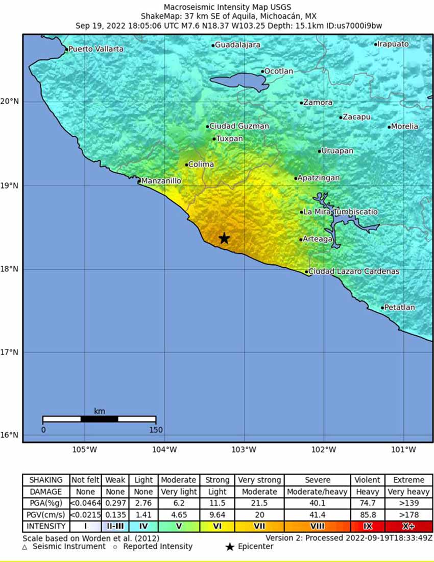
The National Seismological Service reported a 6.8 magnitude tremor at 1:05 p.m. Central Time followed by a 7.7 magnitude quake seconds later (initially estimated at magnitude 7.4). It was followed by several smaller aftershocks at 2:30 p.m., ranging in size from magnitude 5.1 to 5.3.
The U.S. Tsunami Warning Center issued a tsunami threat alert for the area near the epicenter, including any coastal area within 300 kilometers of the epicenter in Coalcomán, Michoacán. The alert applies to a number of urban areas, including Manzanillo, Colima; Lázaro Cárdenas, Michoacán; and Zihuatanejo, Guerrero. Colima Civil Protection later advised that a tsunami was unlikely as of 5:30 p.m. Central Time, but advised coastal residents to stay away from the beach, as there are may be unusual currents or wave activity.
The National Autonomous University of Mexico (UNAM) reported such a variation: their monitoring station in Manzanillo registered a 1.24-meter rise in sea level after the earthquake.

With reports from Animal Político