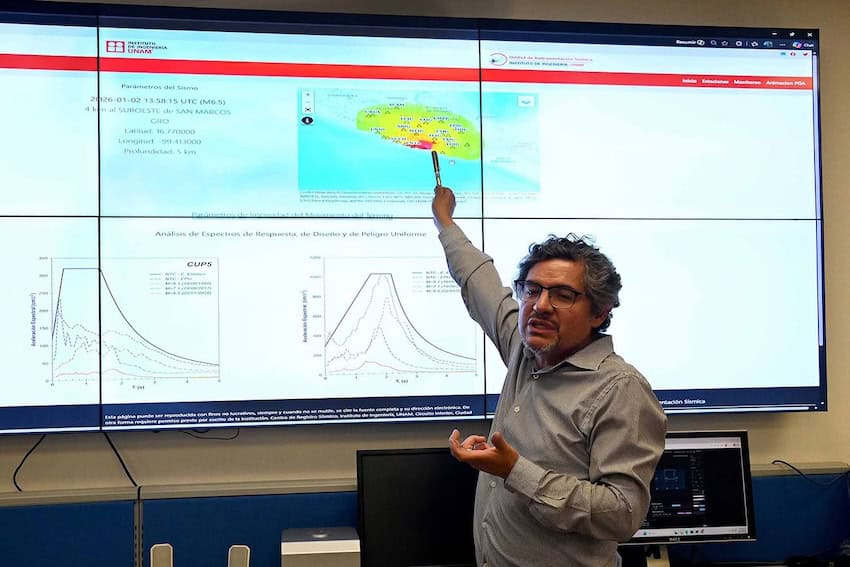
The National Autonomous University of Mexico (UNAM) announced this week it is building 58 new seismic monitoring stations nationwide, targeting the historically under-instrumented north.
Much of the expansion covers the Baja California peninsula, as well as the states of Sonora, Chihuahua, Coahuila and Nuevo León.
📡 La UNAM instalará 58 nuevas estaciones sísmicas en el país, con enfoque especial en el norte, históricamente desatendido pese a su actividad tectónica.
🏗️ La red permitirá calcular epicentros y magnitudes con mayor precisión y generar mapas de intensidad minutos después de un… pic.twitter.com/xtuNrinY8d
— POSTA CDMX (@POSTACDMX) July 30, 2026
The monitoring stations and their computers don’t make earthquake predictions; rather, they collect data and can provide rapid damage-assessment tools that deliver near-real-time data for emergency crews.
Northern Mexico is often seen as low-risk for earthquakes, but Leonardo Ramírez Guzmán, head of the seismic research unit with UNAM’s Institute of Engineering, pushed back on the assumption.

“There is a misconception that earthquakes don’t occur in those regions,” he said. “However, seismic activity is also recorded there, so having more stations will allow for more precise identification and study of these events.”
Guerrero currently has the most stations with 34, followed by 30 in Oaxaca with two more under construction.
And then there’s Mexico City: With roughly 100 stations operating, CDMX ranks among the world’s densest networks, comparable to Tokyo and Los Angeles. Sensors in CDMX even picked up an “artificial earthquake” after Mexico scored an important goal at Estadio Azteca during the World Cup.
The expansion project is funded by the Ministry of Security and Citizen Protection (SSPC) with support from the National Center for Disaster Prevention (Cenapred).
In addition to the building of more stations, UNAM is also rolling out a platform that shows earthquake intensity maps less than an hour after a tremor — a system that was validated after a magnitude 6.5 quake shook Guerrero on Jan. 2.
UNAM said its shake-intensity readings, taken as the temblor occurred and available in about 40 minutes, ended up matching actual damage reports, including which buildings were affected and which areas were hit hardest.
Mexico’s seismic infrastructure includes the Sasmex alert system, considered the world’s oldest public earthquake early-warning service, dating to 1991, and a joint Mexico-Japan deep-sea sensor deployment off Oaxaca.
According to data from Mexico’s National Seismological Service (SSN), there have been 15 earthquakes of magnitude 7.0 or larger in Mexico over the past 25 years — most concentrated along the Pacific coast states of Guerrero, Oaxaca, Chiapas, Michoacán, Colima and Jalisco.
A separate study using data from 1787 through 2022 found that Mexico recorded 322 earthquakes of magnitude 6.5 or greater and 151 of 7.0 or greater over those 235 years — averaging out to about seven 6.5+ earthquakes every five years.
With reports from El Financiero, UNAM Global and Excélsior