

In last week’s “Mexico in Numbers” article we presented 10 facts about the Mexico-U.S. border. This week, we shift our focus to Mexico’s other land borders, those it shares with the Central American nations of Belize and Guatemala.
To enhance your knowledge of Mexico’s southern border, here’s a quick crash course in 10 numbers.
959
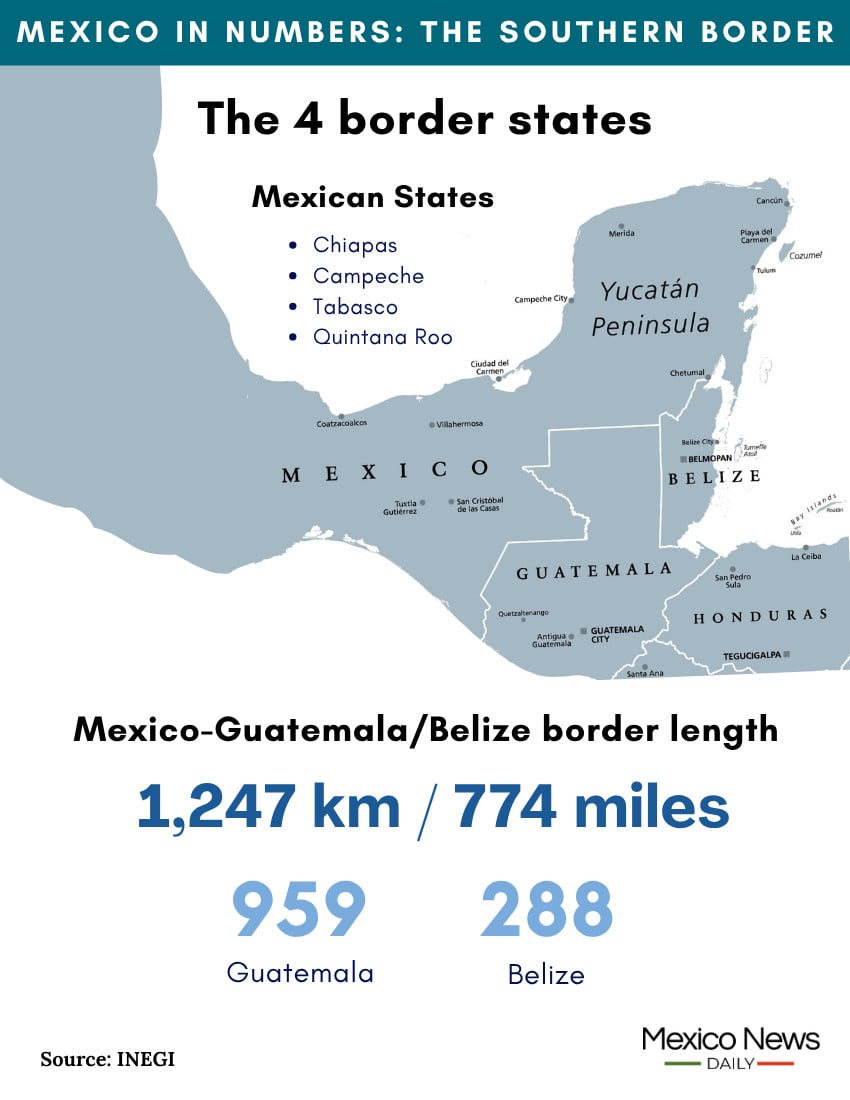
This is the length in kilometers of the Mexico-Guatemala border, according to national statistics agency INEGI. The border runs from the Pacific coast in the municipality of Suchiate, Chiapas, to the tripoint monument between Mexico, Guatemala and Belize. The monument is located near Pioneros del Río Xnohá, a community in the municipality of Calakmul, Campeche.
The length of the Mexico-Guatemala border is just under one-third (30.5%) of the length of the Mexico-U.S. border, which measures 3,145 kilometers. The Mexico-Guatemala border includes stretches of the Suchiate and Usumacinta Rivers.
288
This is the length in kilometers of the Mexico-Belize border, according to INEGI. The border, largely formed by the Hondo River, runs from southwestern Quintana Roo to Boca Bacalar Chico, a maritime canal south of Mahahual, a Caribbean coast town in the municipality of Othón P. Blanco, Quintana Roo.
The Mexico-Belize border is just under one-third (30%) the length of the Mexico-Guatemala border. The Mexico-U.S. border is about 11 times longer than the Mexico-Belize border.

1,247
This is the length in kilometers of Mexico’s entire southern border — i.e., the sum of the lengths of the Mexico-Guatemala border and the Mexico-Belize border.
The Mexico-U.S. border is just over 2.5 times longer than the combined length of the borders between Mexico and Guatemala and Mexico and Belize.
4
This is the number of Mexican states on Mexico’s southern border. Three states — Chiapas, Campeche and Tabasco — border Guatemala. Quintana Roo is the only Mexican state that borders Belize.
23
This is the number of Mexican municipalities that border Guatemala and Belize. Located on Mexico’s border with Guatemala are 18 municipalities in Chiapas, two in Tabasco and two in Campeche. The only Mexican municipality that borders Belize is Othón P. Blanco, Quintana Roo, where the state capital Chetumal is located.
5.7 million
This is the approximate size, in hectares, of the Great Maya Forest Biocultural Corridor, an area spanning parts of Mexico, Guatemala and Belize that is dedicated to protecting and preserving the biodiversity and cultural heritage of the region.
The corridor is the result of a historic agreement between Mexico, Guatemala and Belize that was signed by the leaders of the three countries in Campeche in August 2025.
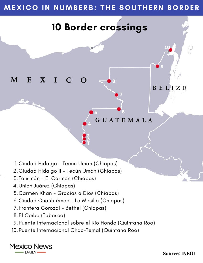
8
This is the number of official border crossings between Mexico and Guatemala. On the Mexican side, seven of those crossings are in Chiapas and one is in Tabasco.
2
This is the number of official land border crossings between Mexico and Belize. Two international bridges, the Santa Elena International Bridge and the nearby Chac-Temal International Bridge, cross the Hondo River into Belize southwest of Chetumal. The Santa Elena International Bridge is currently being rebuilt.
353,706
This was the population of Tapachula, the largest Mexican city within 50 kilometers of the southern border, when Mexico’s most recent census was conducted in 2020. Tapachula is the first port of call in Mexico for many migrants from Central America, South America and further afield who enter the country via the southern border with Guatemala.
The second largest city within 50 kilometers of the southern border is Chetumal, the capital of Quintana Roo. Its population was 233,648 when the 2020 census was conducted.
8
This is the percentage rate of Mexico’s IVA (value-added tax) in the southern border region. The same rate applies in the northern border region. The IVA in the rest of the country is 16%.
Of course, many other numbers could be included in a Mexico in Numbers article on Mexico’s southern border. Let us know of any that come to mind!
Mexico News Daily