The National Weather Service (SMN) and the National Water Commission (Conagua) are tracking a storm system off the coast of El Salvador that is expected to bring heavy rain to the southwestern states of Chiapas and Oaxaca this weekend.
In a social media post early Tuesday, the SMN said it is monitoring a low-pressure system about 670 km south-southeast of the Suchiate River at the Mexico-Guatemala border. The storm was moving slowly in a west-northwesterly direction.
The storm has a 10% chance of developing into a tropical cyclone by Thursday, appearing off the coast of Oaxaca and Chiapas between June 27-29. Conagua is forecasting that the storm has a 70% chance of becoming a tropical cyclone next week by which time it will approach the states of Jalisco, Michoacán and Guerrero.
If the system becomes a tropical storm, it will be named Flossie.
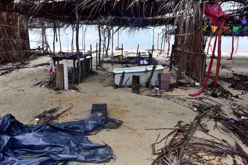
Oaxaca and Guerrero are still cleaning up after Hurricane Erick made landfall on Thursday, dumping considerable rain on those two states through Sunday. The National Civil Protection Commission (CNPC) said Erick damaged at least 26,000 homes in those two states, nearly 20% of the buildings in the 17 municipalities where it hit hardest.
The CNPC was still assessing the damage at 286 school buildings in the affected area, while federal authorities worked to re-open roads and highways, supply potable water and provisions and address health considerations to prevent epidemiological outbreaks.
Mexico is confronted with the onset of the most active tropical cyclone season in recent memory. There have already been three named tropical storms (Alvin, Cosme and Dalila), one Category 1-2 hurricane (Barbara) and a Category 3 hurricane (Erick), the strongest hurricane to hit Mexico so early in the year.

While Oaxaca and Chiapas brace for drenching rains, storm surge and high winds in the coming days, meteorological models project the current storm could remain parallel to Mexico’s southwestern coast, eventually impacting Baja California Sur as a tropical storm. However, it could also veer west away from the coast.
Even if the storm does not make landfall, Conagua is forecasting it will produce heavy rains as far inland as Puebla in central Mexico and, as it continues on its northward path, states such as Colima, Nayarit, Sinaloa, Sonora, Chihuahua and Durango could see severe rainstorms.
In the meantime, seasonal rains will continue to drench much of Mexico, according to the SMN, as low-pressure systems are interacting with troughs of low atmospheric pressure from the Yucatán Peninsula north to the Mesa Central.
Heavy rains are forecast on Tuesday in Hidalgo, Puebla, Veracruz, Oaxaca, Chiapas and Tabasco. The newspaper Debate even headlined its story about rains in Mexico City and México state thusly: “Don’t go outside without a boat.”
With reports from Expreso, El Universal, N+ and La Jornada Maya